Jayankondam
| Jayankondam | |
|---|---|
| Town | |
 Jayankondam Location in Tamil Nadu, India | |
| Coordinates: 11°12′43″N 79°21′54″E / 11.212°N 79.365°ECoordinates: 11°12′43″N 79°21′54″E / 11.212°N 79.365°E | |
| Country |
|
| State | Tamil Nadu |
| District | Ariyalur |
| Government | |
| • Type | Second Grade Municipality |
| • Body | Jayankondan Municipality |
| Population (2011) | |
| • Total | 33,945 |
| Languages | |
| • Official | Tamil |
| Time zone | IST (UTC+5:30) |
| PIN | 621802 |
| Telephone code | 04331 |
| Vehicle registration | TN 61 |
| Website | http://jkmonline.com |
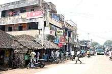
Jayankondam is a Second Grade Municipality in Ariyalur district in the India of Tamil Nadu. It is also called Jayamkondacholapuram. As of 2011, the town had a population of 33,945.
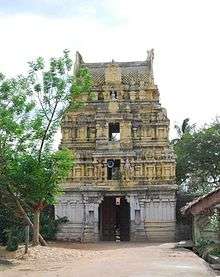
Huge amounts of lignite deposits have been found here and power projects have been initiated by the Neyveli Lignite Corporation.[1] This town has more than 25 temples of various historical periods in the vicinity. The existing Government Higher Secondary School at Jayankondam is as the old as the town and has nearly 2000 Students to its name.
Location
Jayankondam is located 247 km away from Chennai. On the south around 29 km from kumbakonam via Neelathanallur-Mathanathur bridge. On the West and 38 km away from Ariyalur. On the North 25 km from Srimueshnam. On the North and 36 km away from Viruthachalam. On the east and 50 km from away Chidambaram.
Jayankondam Town limit extends over an area of 28 km2.
Demographics
According to 2011 census, Jayankondam had a population of 33,945 with a sex-ratio of 1,031 females for every 1,000 males, much above the national average of 929.[2] A total of 3,520 were under the age of six, constituting 1,866 males and 1,654 females. Scheduled Castes and Scheduled Tribes accounted for 17.88% and 2.06% of the population respectively. The average literacy of the town was 72.%, compared to the national average of 72.99%.[2] The town had a total of : 8664 households. There were a total of 12,359 workers, comprising 611 cultivators, 1,386 main agricultural labourers, 1,004 in house hold industries, 7,592 other workers, 1,766 marginal workers, 87 marginal cultivators, 736 marginal agricultural labourers, 329 marginal workers in household industries and 614 other marginal workers.[3] As per the religious census of 2011, Jayankondam (M) had 92.63% Hindus, 4.53% Muslims, 2.42% Christians, 0.06% Sikhs, 0.01% Buddhists, 0.01% Jains, 0.31% following other religions and 0.03% following no religion or did not indicate any religious preference.[4]
Places near Jayankondam
Gangaikonda Cholapuram temple is the place near 8 km. East from JKM is the ancient – temple Rajendra chozha having very ancient – oldest sculpture and drowning.
Anaikarai is 15 km from Jayanokondam
PIN (Postal Index) Code for Jayankondam is 621802. Also the following nearby post offices share the same pin Angarayanallur, Chinnavalayam, Kaluvanthondi, Karadikulam, Kilakudiyiruppu, Periyavalayam and Sengunthapuram.[5]
Jayankondam assembly constituency is part of Chidambaram.[6]


References
- ↑ http://newindianexpress.com/states/tamil_nadu/article529907.ece
- 1 2 "Census Info 2011 Final population totals". Office of The Registrar General and Census Commissioner, Ministry of Home Affairs, Government of India. 2013. Retrieved 26 January 2014.
- ↑ "Census Info 2011 Final population totals - Jayankondam". Office of The Registrar General and Census Commissioner, Ministry of Home Affairs, Government of India. 2013. Retrieved 26 January 2014.
- ↑ "Population By Religious Community - Tamil Nadu" (XLS). Office of The Registrar General and Census Commissioner, Ministry of Home Affairs, Government of India. 2011. Retrieved 13 September 2015.
- ↑ "List of Post Offices for Pin Code 621802". Pin code. Retrieved 22 August 2011.
- ↑ "List of Parliamentary and Assembly Constituencies" (PDF). Tamil Nadu. Election Commission of India. Retrieved 2008-10-11.
External links
- JKMOnline.com - Information about Jayankondam
- Jayankondam Town information
- Jayankondam People around the world cumminity site
- - Gangaikondacholapuram - Bragatheeswarar Temple - Site