Johnson Col
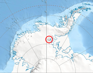
Location of Sentinel Range in Western Antarctica.
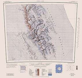
Sentinel Range map.
Johnson Col (78°22′S 85°10′W / 78.367°S 85.167°WCoordinates: 78°22′S 85°10′W / 78.367°S 85.167°W) is a col at about 1,800 metres (5,900 ft), located in the Sullivan Heights 2 nautical miles (4 km) west-southwest of Mount Farrell in the central part of the Sentinel Range of the Ellsworth Mountains, Antarctica. It was first mapped by the United States Geological Survey from surveys and U.S. Navy air photos, 1957–59, and was named by the Advisory Committee on Antarctic Names for Earl F. Johnson, a U.S. Navy utilitiesman at South Pole Station in 1957.[1]
Maps
- Vinson Massif. Scale 1:250 000 topographic map. Reston, Virginia: US Geological Survey, 1988.
References
- ↑ "Johnson Col". Geographic Names Information System. United States Geological Survey. Retrieved 2012-07-27.
![]() This article incorporates public domain material from the United States Geological Survey document "Johnson Col" (content from the Geographic Names Information System).
This article incorporates public domain material from the United States Geological Survey document "Johnson Col" (content from the Geographic Names Information System).
This article is issued from Wikipedia - version of the 11/21/2015. The text is available under the Creative Commons Attribution/Share Alike but additional terms may apply for the media files.