Journal Square Transportation Center
The Journal Square Transportation Center is a multi-modal transportation hub located on Kennedy Boulevard at Journal Square in Jersey City, New Jersey, United States.[2] Owned and operated by the Port Authority of New York and New Jersey, the complex includes a ten-story tower, a retail plaza, a bus terminal, a two-level parking facility, and the Journal Square station of the PATH rail transit system. The underground station has a high ceiling and a mezzanine level connecting the platforms. The upper level of the station contains a bank of escalators leading to street level, elevators to parking, and a series of escalators leading to the street-level bus bays.
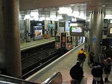
History and vicinity
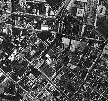
The JSTC was originally the site of the Summit Avenue Station of the Hudson and Manhattan Railroad. Summit Avenue station was built on April 14, 1912. The district was renamed Journal Square in the 1920s.
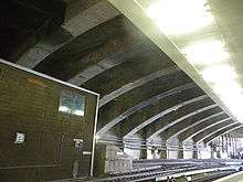
The open-spandrel concrete arch bridge carrying Kennedy Boulevard and the station, built in 1926, is a pared-down version of a more ambitious elevated plaza scheme proposed by consulting engineer Abraham Burton Cohen. Passageways were suspended from the arches to connect the railroad station to bus stops on the bridge deck above.[3] The original mid-roadway bus stop islands have since been removed.
The H&M was acquired by PATH in 1962, and reconstruction of the station began in 1968.[4] Though the cornerstone was installed on September 20, 1972, the center itself was opened in stages in 1973, 1974, and 1975[5] during the late phases of the Brutalist architecture movement. It is constructed over the Bergen Hill Cut, an excavated ravine, originally opened in 1834 and later used by the Jersey City Branch of the Pennsylvania Railroad. Freight trains on the Passaic and Harsimus Line occasionally make use of the cut to traverse the Palisades along tracks north of the mass transit system.
The center is sometimes viewed as having contributed to the decline of the district by moving the train-bus interchange, and thus pedestrians, away from other commercial activities around the square.[6]
A statue of Jackie Robinson was dedicated at the center in 1998.[7]
The Loew's Jersey Theater, the Stanley Theater, Hudson County Community College, Journal Squared, Hudson County Courthouse and Hudson County Administration Building are in the immediate vicinity. Nearby are the neighborhoods Bergen Square, India Square, Marion Section, Five Corners, the Hilltop, and McGinley Square site of Beacon and Saint Peter's College are
Rapid transit
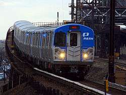
The Journal Square PATH station opened on April 14, 1912, as the Summit Avenue Station of the Hudson and Manhattan Railroad. Currently it is served by two lines of the Port Authority Trans Hudson, being the terminus of the Journal Square – 33rd Street route.[8] At the platform level, the inside tracks are typically used by the Journal Square – 33rd Street trains, while the outside tracks are used by the Newark – World Trade Center trains.[9]
Bus
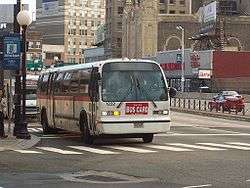
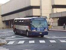
Regular frequent bus service is provided by New Jersey Transit and private enterprises for points throughout Hudson County and to the Port Authority Bus Terminal in Midtown Manhattan. There is also service to Newark, Hackensack, the Jersey Shore and Atlantic City .[10] Bus arrivals and departures use platforms accessible from within the station or via Pavonia or Sip Avenues.
| Route | destination | major points |
|---|---|---|
| Bergen Avenue A&C Bus Corp. |
Greenville | Bergen Square McGinley Square Bergen Avenue Old Bergen Road |
| 1 NJT[11] |
Newark-Ivy Hill via Newark-Ironbound |
West Side Lincoln Highway Ferry Street/Raymond Boulevard Market Street 16th Avenue |
| 2 NJT[12] |
Secaucus Junction | Kennedy Boulevard County Avenue Meadowlands Parkway |
| 6 NJT[13] |
Greenville Merritt Street or Lafayette Loop Liberty State Park |
Summit Avenue Communipaw Junction Ocean Avenue |
| 10 | Bayonne JFK Blvd and 3rd Street |
Kennedy Boulevard |
| 64N limited weekday service no weekend service NJT[14] |
Lakewood NJT Bus Terminal |
U.S. Route 9 |
| 67 limited service NJT[15] |
Toms River Park and Ride via Lakewood seasonal: Seaside Heights |
U.S. Route 9 Route 549 |
| 80 eastbound NJT[16] |
Exchange Place | Newark Avenue |
| 80 southbound NJT[16] |
Greenville regular service |
West Side Avenue |
| 83 NJT[17] |
Hackensack Bus Terminal | Summit Avenue Bergen Turnpike Tonnelle Avenue U.S. Route 46 Main Street |
| 84 NJT[18] |
Nungesser's North Bergen |
Newark Avenue Palisade Avenue Bergenline |
| 87 southbound NJT[19] |
Greenville Gates Avenue |
Bergen Square MLK Drive Old Bergen Road |
| 87 northbound NJT[19] |
Hudson Place Hoboken Terminal |
Central Avenue Palisade Avenue 9th Street-Congress Street HBLR Paterson Plank Road |
| 88 NJT[20] |
Nungesser's North Bergen |
Kennedy Boulevard |
| 119 No Sunday service |
Port Authority Bus Terminal 42nd Street (Manhattan) |
Kennedy Boulevard 9th Street-Congress Street HBLR 14th Street Viaduct |
| 125 NJT[21] |
Port Authority Bus Terminal 42nd Street (Manhattan) |
Kennedy Boulevard Marginal Highway |
| 319 NJT[22] |
Atlantic City Bus Terminal or Wildwood Bus Terminal Seasonal: Cape May |
Garden State Parkway Express to Sea Isle City (stops in Toms River) |
| 440 Shopper A&C Bus Corp. http://www.acbuscorp.com |
Hudson Mall | Marion Section West Side Avenue Route 440 |
| Bergenline Avenue Jitney[23] Multiple carriers |
Newport Mall George Washington Bridge Plaza |
Newark Avenue Palisade Avenue Bergenline Fort Lee |
| JFK Boulevard Jitney Community Lines |
Port Authority Bus Terminal 42nd Street (Manhattan) |
Kennedy Boulevard Union City |
| Society Hill A&C Bus Corp. http://www.acbuscorp.com |
Society Hill | Marion Section West Side Avenue Droyer's Point |
Layout
| Ground | Street level | PATH exit/entrance, bus terminal |
| Mezzanine | Mezzanine | Entrance/Exit, automatic ticket dispensing machines, one-way faregates |
| Platforms | Westbound | ← NWK-WTC toward Newark (Harrison) |
| Island platform, doors will open on the left, right | ||
| Westbound | ← JSQ-33 JSQ-33 (via HOB) alighting passengers only | |
| Eastbound | → JSQ-33 toward 33rd Street (Grove Street) → → JSQ-33 (via HOB) toward 33rd Street (Grove Street) → | |
| Island platform, doors will open on the left, right | ||
| Eastbound | → NWK-WTC toward World Trade Center (Grove Street) → | |
References
- ↑ "PATH Ridership Report" (PDF). pathnynj.gov. Port Authority of New York and New Jersey. Retrieved 30 October 2016.
- ↑ Wikipmapia JSQ Trans Ctr
- ↑ Cohen, A. Burton. "Hudson County Boulevard Bridge Plaza." Purdue Engineering Review 21, No. 4 (May 1926): 3-6, 22.
- ↑ Construction of The PATH Journal Square Transportation Center; 1968
- ↑ Port Authority:JSQ Trans Ctr history
- ↑ Angel, Karen. "Journal Squared: A Jersey City neighborhood's housing multiplies." The New York Daily News. Friday November 13, 2009. 1. Retrieved on November 13, 2009.
- ↑ Robinson statue and marker
- ↑ Port Authority: JSQ Trans Ctr
- ↑ Marrero, Robert (2015-09-13). "469 Stations, 846 Miles" (PDF). B24 Blog, via Dropbox. Retrieved 2015-10-09.
- ↑ JSQ carriers and routes
- ↑ NJT bus 1 schedule
- ↑ NJT bus 2 schedule
- ↑ NJT bus 6 schedule
- ↑ NJT bus 64 schedule
- ↑ NJT bus 67 schedule
- 1 2 NJT 80 schedule Archived July 4, 2009, at the Wayback Machine.
- ↑ NJT 83 schedule
- ↑ NJT 84 schedule
- 1 2 NJT bus 87 schedule
- ↑ NJT bus 88 schedule
- ↑ NJT bus 125 schedule
- ↑ NJT bus 319 schedule
- ↑ http://www.jerseyjitneys.info/?page_id=15
External links
| Wikimedia Commons has media related to Journal Square Transportation Center. |
- PATH - Journal Square
- NJT Bus Routes in Hudson County
- Kennedy Boulevard entrance from Google Maps Street View


.jpg)
