Karangasem Regency
| Karangasem Regency Kabupaten Karangasem | ||
|---|---|---|
| Regency | ||
| ||
 Location of Karangasem Regency in Bali | ||
| Country | Indonesia | |
| Province | Bali | |
| Capital | Amlapura | |
| Area | ||
| • Total | 324.15 sq mi (839.54 km2) | |
| Time zone | WITA (UTC+8) | |
| Area code(s) | +62 363 | |
| Website | http://www.karangasemkab.go.id/ | |


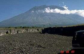

Karangasem Regency (Indonesian: Kabupaten Karangasem) is a regency (kabupaten) of Bali, Indonesia. It covers the east part of Bali, has an area of 839.54 km2 and a population of 369,320 (2002). Its regency seat is Amlapura. Karangasem was devastated when Mount Agung erupted in 1963, killing 1,900 people. Karangasem was a kingdom before Bali was conquered by the Dutch.
Administration
The regency is divided into eight districts (Kecamatan), listed below with their 2010 Census populations:[1]
- Rendang, Bali 36,931
- Sidemen 31,617
- Manggis 44,041
- Karangasem 82,606
- Abang 60,965
- Bebandem 45,160
- Selat 38,114
- Kubu 57,053
- Kubu 58,053
Saren Jawa
Hindus and Muslims live in Budakeling, Karangasem. Saren Jawa village is home to 100 Muslims families and surrounded by Balinese Hindus villages following the Siwa-Buda belief system, an amalgamation of Hinduism and Mahayana Buddhist. The people of Saren Jawa use Balinese first names before their Muslim last names, such as Ni Nyoman Maimunah.[2]
Tourism
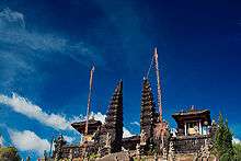
Interesting places are:
- The Mother Temple of Besakih
- Tenganan, a Bali Aga village (the original Bali), with inhabitants who still live according to their ancient traditions
- Beach town of Amed.
- Candidasa is a good starting point for visiting places along the beautiful east coast of Bali. A little east of Candidasa, the village Bugbug is located. Its inhabitants celebrate the Perang Dawa (war of the gods) every other year at full moon of the fourth month (October). People of all nearby villages then climb to the top of a hill and sacrifice pigs by hanging them in trees.
- Prasi Beach in Prasi village is called also as Pantai Pasir Putih (White Sandy Beach) and nowadays as Virgin Beach, certainly has white sandy beach which cleans, still hidden from crowd, less polluted and best for swimming or snorkeling in April to October, a 7 kilometers (20 minutes) drive from Candidasa to the east.[3] The beach is hidden among two cliffs/hills, Bugbug Cliff and Prasi Cliff.[4]
References
- ↑ Biro Pusat Statistik, Jakarta, 2011.
- ↑ "Saren Jawa — a model of harmony". August 25, 2011.
- ↑ Wayan Suadnyana. "Bali White Sand Beach". Retrieved August 24, 2014.
- ↑ Adji Soedibjo. "Pantai Pasir Putih: Bali's Virgin Beach". Retrieved February 19, 2015.
External links
 East Bali travel guide from Wikivoyage
- Official site (new) (Indonesian)
- Official site (old) (Indonesian)
 |
Wikimedia Commons has media related to Karangasem. |

Coordinates: 8°22′S 115°31′E / 8.367°S 115.517°E