Katzir
For the surname, see Katzir (surname).
For other uses, see Katzir (disambiguation).
| Katzir קציר | |
|---|---|
  Katzir | |
| Coordinates: 32°29′17″N 35°06′07″E / 32.48806°N 35.10194°ECoordinates: 32°29′17″N 35°06′07″E / 32.48806°N 35.10194°E | |
| District | Haifa |
| Council | Menashe |
| Founded | 1982 |
| Founded by | Hitahdut HaIkarim |
| Population (2015)[1] | 2,776 |
| Website | www.mykatzir.co.il |
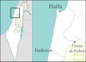
Katzir (Hebrew: קציר) is a Jewish locality in northern Israel. Located south-west of Umm al-Fahm and close to the Green Line, it falls under the jurisdiction of Menashe Regional Council. In 2015 it had a population of 2,776.
History
The village was established in 1982 by Hitahdut HaIkarim on land owned by the Jewish Agency, and was initially a Community settlement. In 1993 it was merged with neighbouring Harish to form Katzir-Harish local council. However, in 2012 the two were separated, with Harish remaining a local council and Katzir reverting to the jurisdiction of Menashe Regional Council.
References
- ↑ "List of localities, in Alphabetical order" (PDF). Israel Central Bureau of Statistics. Retrieved 16 October 2016.
External links
This article is issued from Wikipedia - version of the 9/29/2016. The text is available under the Creative Commons Attribution/Share Alike but additional terms may apply for the media files.