Kentallen railway station
| Kentallen | |
|---|---|
|
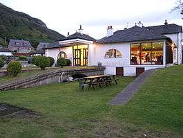
Hotel and restaurant on the site of Kentallen station, in 2005 | |
| Location | |
| Area | Highland |
| Coordinates | 56°40′29″N 5°14′38″W / 56.6747°N 5.2439°WCoordinates: 56°40′29″N 5°14′38″W / 56.6747°N 5.2439°W |
| Operations | |
| Original company |
Callander and Oban Railway Ballachulish Branch |
| Pre-grouping | Callander and Oban Railway operated by Caledonian Railway |
| Post-grouping | LMS |
| Platforms | 2 |
| History | |
| 24 August 1903 | Opened[1] |
| 25 May 1953 | Closed[1] |
| 24 August 1953 | Re-opened[1] |
| 28 March 1966 | Closed[1] |
| Disused railway stations in the United Kingdom | |
|
Closed railway stations in Britain A B C D–F G H–J K–L M–O P–R S T–V W–Z | |
|
| |
Kentallen was a railway station at the head of Kentallen Bay, which is on the southern shore of Loch Linnhe in Highland.
History
This station opened on 20 August 1903. It was laid out with two platforms, one on either side of a crossing loop. There were sidings on the east side of the line.
The station had a short closure during 1953[1] and finally closed in 1966, when the Ballachulish Branch of the Callander and Oban Railway was closed.
Following closure the station buildings were converted into a hotel and restaurant.
| Preceding station | Historical railways | Following station | ||
|---|---|---|---|---|
| Duror Line and station closed |
Callander and Oban Railway Ballachulish Branch Caledonian Railway |
Ballachulish Ferry Line and station closed | ||
Signalling
Throughout its existence, the Ballachulish Branch was worked by the electric token system. Kentallen signal box was located on the Up platform, on the east side of the railway. It had 24 levers.
References
Notes
Sources
- Butt, R. V. J. (1995). The Directory of Railway Stations: details every public and private passenger station, halt, platform and stopping place, past and present (1st ed.). Sparkford: Patrick Stephens Ltd. ISBN 1-8526-0508-1. OCLC 60251199.
- Fryer, Charles (1989). The Callander and Oban Railway. Oxford: Oakwood Press. ISBN 0-8536-1377-X. OCLC 21870958.
- Jowett, Alan (March 1989). Jowett's Railway Atlas of Great Britain and Ireland: From Pre-Grouping to the Present Day (1st ed.). Sparkford: Patrick Stephens Ltd. ISBN 1-8526-0086-1. OCLC 22311137.
- Jowett, Alan (2000). Jowett's Nationalised Railway Atlas (1st ed.). Penryn, Cornwall: Atlantic Transport Publishers. ISBN 0-9068-9999-0. OCLC 228266687.
- Kentallen station on navigable 1954 map
- RAILSCOT on Callander and Oban Railway
This article is issued from Wikipedia - version of the 7/27/2016. The text is available under the Creative Commons Attribution/Share Alike but additional terms may apply for the media files.
