Kentucky Route 509
| ||||
|---|---|---|---|---|
| Route information | ||||
| Maintained by KYTC | ||||
| Length: | 9.782 mi[1] (15.743 km) | |||
| Major junctions | ||||
| West end: |
| |||
| East end: |
| |||
| Highway system | ||||
| ||||
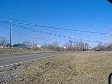
Kentucky Route 509 is a state highway in central Kentucky, with its eastern terminus at Kentucky Route 48 just west of Fairfield, Kentucky, and end just east of Samuels, Kentucky at Kentucky Route 245. It crosses U.S. Route 31E/U.S. Route 150 at Coxs Creek. East of Coxs Creek the road is also known as Fairfield Road, and east of Coxs Creek it is called Samuels Road. The Coxs Creek intersection was historically a dangerous area for accidents.[2]
Route description

KY 509 begins at an intersection with KY 245 near Samuels in Nelson County, heading north on two-lane undivided Samuels Loop. The route passes through rural areas with some development and intersects the southern terminus of KY 3207, at which point it turns east onto Samuels Road and immediately crosses a R.J. Corman Railroad line. The road continues through farmland with some woods and homes, curving to the northeast. KY 509 heads to the east again and comes to an intersection with US 31E/US 150 in Coxs Creek. Following this intersection, the route becomes Fairfield Road and continues through more agricultural areas with some trees and residences. KY 509 curves to the northeast and continues to its eastern terminus at an intersection with KY 48 west of Fairfield.[1][3]
Major intersections
The entire route is in Nelson County.
| Location | mi[1] | km | Destinations | Notes | |
|---|---|---|---|---|---|
| Samuels | 0.000 | 0.000 | |||
| 0.511 | 0.822 | ||||
| Coxs Creek | 4.550 | 7.323 | |||
| Fairfield | 9.782 | 15.743 | |||
| 1.000 mi = 1.609 km; 1.000 km = 0.621 mi | |||||
References
- 1 2 3 Commonwealth of Kentucky. "Official DMI Route Log". Retrieved 26 December 2012.
- ↑ Rennick p.70
- ↑ Google (February 7, 2013). "overview of Kentucky Route 509" (Map). Google Maps. Google. Retrieved February 7, 2013.
Works cited
- Rennick, Robert M. (1988). Kentucky Place Names. University Press of Kentucky. ISBN 0-8131-0179-4.
