Kobeliaky
| Kobeliaky Кобеляки | |||
|---|---|---|---|
|
Church in Kobeliaky | |||
| |||
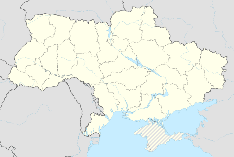  Kobeliaky Location of Kobeliaky | |||
| Coordinates: 49°08′00″N 34°12′00″E / 49.13333°N 34.20000°ECoordinates: 49°08′00″N 34°12′00″E / 49.13333°N 34.20000°E | |||
| Country Oblast Raion |
 Ukraine UkrainePoltava Oblast Kobeliaky Raion | ||
| Founded | 1620 | ||
| Area | |||
| • Total | 1.21 km2 (0.47 sq mi) | ||
| Elevation | 80 m (260 ft) | ||
| Population (2015) | |||
| • Total | 9,977 | ||
| Time zone | EET (UTC+2) | ||
| • Summer (DST) | EEST (UTC+3) | ||
| Postal code | 39200—39204[1] | ||
| Vehicle registration | BI[2] | ||


Kobeliaky (Ukrainian: Кобеляки) is a city in Poltava Oblast, Ukraine. Population is 9,977 (2015 est.)[3].
History
During World War II, Kobeliaky was under German occupation from 15 September 1941 until 25 September 1943.
Famous people from Kobeliaky
- Nikolai Timofeyevich Gres, soloist with the Bolshoi Theatre and the Alexandrov Ensemble
Gallery
 Historical building in Kobeliaky
 Bus station
 Shops in Kobeliaky
References
- ↑ Ukrainian Zip Codes
- ↑ Как расшифровываются новые номера
- ↑ "Чисельність наявного населення України (Actual population of Ukraine)" (PDF) (in Ukrainian). State Statistics Service of Ukraine. Retrieved 1 July 2016.
External links
- Kobeliaky
- Photogallery of the Kobeliaky city
- History of Kobeliaky city (in Ukrainian language)
- The murder of the Jews of Kobeliaky during World War II, at Yad Vashem website.
| Raions |  | ||||||
|---|---|---|---|---|---|---|---|
| Cities |
| ||||||
| |||||||

This article is issued from Wikipedia - version of the 11/10/2016. The text is available under the Creative Commons Attribution/Share Alike but additional terms may apply for the media files.