Kovoor Town
| Kovoor | |
|---|---|
| Town | |
 Kovoor Location in Kerala, India | |
| Coordinates: 11°18′23″N 75°52′44″E / 11.30639°N 75.87889°ECoordinates: 11°18′23″N 75°52′44″E / 11.30639°N 75.87889°E | |
| Country |
|
| State | Kerala |
| Region | South India |
| District | Kozhikode |
| Population | |
| • Total | 47,396 |
| Languages | |
| • Official | Malayalam |
| Time zone | IST (UTC+5:30) |
| PIN | 673008 |
| Nearest city | Kozhikode |
| Lok Sabha constituency | Kozhikode |
| Vidhan Sabha constituency | Kunnamangalam |
Kovoor Town is a suburb of Kozhikode city on the eastern side.
Suburbs and Townships
- Chevarambalam, Iringadan-Pally, and Mayanad
- Kottooli and Pottammal, Chevayur and Kavu
- Palazhi, MLA Road and NTMC Enclave.
The Kovoor Walk
On both sides of the national highway in Kovoor Town you can find green paddy fields filled with coconut gardens on the fringes. There is a footpath from Kovoor Town to Iringadan Pally village which takes your further to the Vellimadukunnu Hills on the Wayanad Road. This walk can be extended up to the Poolakkadavu river and the little foot bridge leading to Parambil Bazar town.
Palazhi Road
The MLA Road from Kovoor Town connects to Palazhi or Milky ocean village. There is a famous Vishnu temple on the beginning of this road. The NTMC Road, Amat Road, AKVK Colony and GKN Road originate from this road. Residential pockets like Nellippathazham, Payyadi Meethal, Ummalathoor and Patheer Madam are in this route. The road ends in Palazhy Junction which is on the bypass road with Hilite Mall on the other side of the road.
Chevayur Township
Chevayur is a suburban town of Kozhikode city in India. It is at a distance of 2 km from Calicut Medical College and 5 km from Kozhikode city. Chevayur is near other important residential locations like Chevarambalam, Kovoor Town and Thondayad Junction. On the southern side, Chevayur is connected by SBI Colony Road and Gas Godown Road to Palazhi and Nellikkunnu areas. On the northern side, Chevarambalam road and Iringadan pally Road connects Chevayur with Vellimadukunnu area on the Wayanad road.
Important Landmarks
- Kozhikode Medical College
- Skincare Hospital, Chevayur
- CIGI Training Center, Chevayur [1]
- Presentation school and convent, Chevayur
- St. Joseph Devagiri College.
- Ravishankar School, MLA Road.
Mavoor Road after Medical College
The term Mavoor Road is used only for the 8.3 km stretch of road between Mananchira and Calicut Medical College. The road goes another 13 kam and ends in Mavoor town. This second stretch of Mavoor town has many important towns and villages like:
See also
Location
 |
Malaparamba | Silver Hills | Kunnamangalam | |
| Chevarambalam Junction | |
Mavoor | ||
| ||||
| | ||||
| Chevayur | Palazhi |
Image gallery
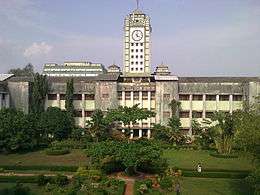 View from inside the medical college
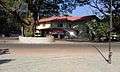 Coffee House at Medical College
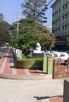 Maternity Hospital at Chevayoor
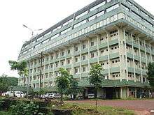 Super Speciality Hospital
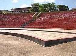 N.I.T.Stadium