Lavsa
 Lavsa | |
| Geography | |
|---|---|
| Location | Adriatic sea |
| Coordinates | 43°45′11″N 15°22′28″E / 43.75306°N 15.37444°ECoordinates: 43°45′11″N 15°22′28″E / 43.75306°N 15.37444°E |
| Archipelago | Kornati Islands |
| Area | 1.78 km2 (0.69 sq mi) |
| Highest elevation | 111 m (364 ft) |
| Highest point | Veli vrh |
| Administration | |
|
Croatia | |
| Demographics | |
| Population | 0 |
Lavsa is an uninhabited Croatian island in the Adriatic Sea located southwest of Kornat. Its area is 1.78 km2 (0.69 sq mi).[1]
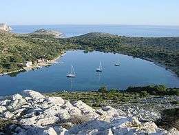
In the bay, there are several houses that are used summer only. Otherwise the island is without inhabitants. The harbor is protected from all winds.
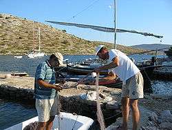
Fisherman in Lavsa
References
- ↑ Duplančić Leder, Tea; Ujević, Tin; Čala, Mendi (June 2004). "Coastline lengths and areas of islands in the Croatian part of the Adriatic Sea determined from the topographic maps at the scale of 1 : 25 000" (PDF). Geoadria. Zadar. 9 (1): 5–32. Retrieved 2011-01-21.
This article is issued from Wikipedia - version of the 8/2/2015. The text is available under the Creative Commons Attribution/Share Alike but additional terms may apply for the media files.