Legyi, Myinmu
| Legyi | |
|---|---|
| Village | |
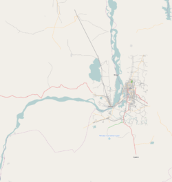 Legyi Location in the Sagaing area and in relation to the Irrawaddy River. | |
| Coordinates: 21°58′10″N 95°42′53″E / 21.96944°N 95.71472°ECoordinates: 21°58′10″N 95°42′53″E / 21.96944°N 95.71472°E | |
| Country |
|
| Region | Sagaing Region |
| District | Sagaing District |
| Township | Myinmu Township |
| Time zone | MST (UTC+6.30) |
Legyi is a large village in Myinmu Township in the southeast of the Sagaing Division in Burma. It is located southeast of Paukka and not far from the banks of the Irrawaddy River which the villagers rely on for their paddy fields which lie to the west of the village.
The village was occupied by the 2nd Infantry Regiment of the British Indian Army during World War II,[1]
References
- ↑ Hugh Toye, Philip Mason (1991). Subhash Chandra Bose. Jaico Publishing House. p. 144. ISBN 81-7224-401-0.
Capital: Sagaing | ||
| Hkamti District |   | |
| Kale District | ||
| Katha District | ||
| Mawlaik District | ||
| Monywa District | ||
| Sagaing District | ||
| Shwebo District | ||
| Tamu District | ||
| Yinmabin District | ||
| Naga Self-Administered Zone | ||
This article is issued from Wikipedia - version of the 11/6/2016. The text is available under the Creative Commons Attribution/Share Alike but additional terms may apply for the media files.