Leominster State Forest
| Leominster State Forest | |
| Massachusetts State Park | |
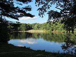
 Crow Hill Pond | |
| Country | United States |
|---|---|
| State | Massachusetts |
| County | Worcester |
| Towns | Leominster, Fitchburg, Princeton, Sterling, Westminster |
| Elevation | 984 ft (300 m) [1] |
| Coordinates | 42°31′15″N 71°50′18″W / 42.52083°N 71.83833°WCoordinates: 42°31′15″N 71°50′18″W / 42.52083°N 71.83833°W [1] |
| Area | 4,246 acres (1,718 ha) [2] |
| Established | Unspecified |
| Management | Massachusetts Department of Conservation and Recreation |
|
Location in Massachusetts | |
| Website: Leominster State Forest | |
Leominster State Forest is a 4,300-acre (1,700 ha) Massachusetts state forest located in the towns of Leominster, Fitchburg, Princeton, Sterling, and Westminster.[3] Plants such as mountain laurel are common within the forest as is an abundance of wildlife. The forest's historical artifacts include cellar holes, stonewalls, fruit trees and other remnants of "No Town," an unincorporated 18th-century settlement that in 1838 was annexed into adjoining municipalities.[3][4]
The forest is headquarters of the Massachusetts Bureau of Forest Fire Control, District 8[5] and is managed by the Department of Conservation and Recreation.
Activities and amenities
- Trails: Forest trails, which include a section of the Midstate Trail, are available for walking, hiking, mountain biking, cross-country skiing, and snowmobiling.
- Crow Hill Pond: Swimming is permitted at the beach on Crow Hill Pond, which has a bathouse and picnicking area.[6]
- Paradise Pond: Non-motorized boating (canoeing and kayaking) is allowed at Paradise Pond.
- Fishing: Barrett's Pond and Crow Hill Pond are stocked with trout in spring by the Division of Fisheries and Wildlife.[7]
- Rock climbing: Rock climbing takes place on the Crow Hills cliffs.[6]
- The forest also offers restricted hunting and interpretive programs.
References
- 1 2 "Leominster State Forest". Geographic Names Information System. United States Geological Survey.
- ↑ "2012 Acreage Listing" (PDF). Department of Conservation and Recreation. April 2012. Retrieved January 17, 2014.
- 1 2 "Leominster State Forest". MassParks. Executive Office of Energy and Environmental Affairs. Retrieved August 15, 2013.
- ↑ Wilder, David (1853). The History of Leominster, or the Northern Half of the Lancaster New or Additional Grant, from June 26, 1701, the Date of the Deed from George Tahanto, Indian Sagamore, to July 4, 1852. Fitchburg, Mass.: Reveille Office. pp. 20–21. Retrieved August 15, 2013.
- ↑ "Fire Warden List" (PDF). Massachusetts Bureau of Forest Fire Control. January 2013. Retrieved August 15, 2013.
- 1 2 "Leominster State Forest Recreation". MassParks. Executive Office of Energy and Environmental Affairs, Department of Conservation and Recreation. Retrieved August 15, 2013.
- ↑ "Trout Stocked Waters - Central District". Executive Office of Energy and Environmental Affairs. Retrieved August 15, 2013.
External links
- Leominster State Forest Department of Conservation and Recreation
- Leominster State Forest Map Department of Conservation and Recreation
This article is issued from Wikipedia - version of the 8/19/2016. The text is available under the Creative Commons Attribution/Share Alike but additional terms may apply for the media files.