Lippert Peak
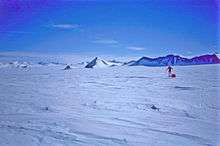
Lippert Peak (79°59′S 81°56′W / 79.983°S 81.933°WCoordinates: 79°59′S 81°56′W / 79.983°S 81.933°W) is a sharp pointed peak at the end of a ridge that extends west from the Douglas Peaks into Horseshoe Valley, located 5 nautical miles (9 km) southeast of Strong Peak (which this peak resembles) in the Heritage Range, Antarctica. It was mapped by the United States Geological Survey from surveys and U.S. Navy air photos from 1961–66, and was named by the Advisory Committee on Antarctic Names for George E. Lippert, a United States Antarctic Research Program biologist at Palmer Station in 1965.[1]
References
- ↑ "Lippert Peak". Geographic Names Information System. United States Geological Survey. Retrieved 2013-06-20.
![]() This article incorporates public domain material from the United States Geological Survey document "Lippert Peak" (content from the Geographic Names Information System).
This article incorporates public domain material from the United States Geological Survey document "Lippert Peak" (content from the Geographic Names Information System).