List of lakes in Chicot County, Arkansas
There are at least 42 named lakes and reservoirs in Chicot County, Arkansas.
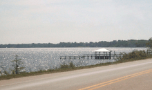
Lake Chicot State Park is the center of recreation and camping on Lake Chicot.
Lakes
- Archer Lake, 33°24′5″N 091°05′27″W / 33.40139°N 91.09083°W, el. 112 feet (34 m)[1]
- Beaver Lake, 33°18′5″N 091°08′56″W / 33.30139°N 91.14889°W, el. 105 feet (32 m)[2]
- Blue Bayou, 33°16′5″N 091°09′25″W / 33.26806°N 91.15694°W, el. 105 feet (32 m)[3]
- Blue Hole Lake, 33°23′5″N 091°05′54″W / 33.38472°N 91.09833°W, el. 105 feet (32 m)[4]
- Camp Lake, 33°25′5″N 091°10′06″W / 33.41806°N 91.16833°W, el. 108 feet (33 m)[5]
- Camp Lake, 33°25′5″N 091°10′02″W / 33.41806°N 91.16722°W, el. 108 feet (33 m)[6]
- Carolina Chute, 33°03′5″N 091°07′20″W / 33.05139°N 91.12222°W, el. 92 feet (28 m)[7]
- Cocklebur Lake, 33°26′5″N 091°08′12″W / 33.43472°N 91.13667°W, el. 108 feet (33 m)[8]
- Cornfield Chute, 33°09′5″N 091°07′11″W / 33.15139°N 91.11972°W, el. 95 feet (29 m)[9]
- Cottonwood Chute, 33°17′5″N 091°08′42″W / 33.28472°N 91.14500°W, el. 112 feet (34 m)[10]
- Dry Lake, 33°25′5″N 091°08′35″W / 33.41806°N 91.14306°W, el. 108 feet (33 m)[11]
- Duck Lake, 33°26′5″N 091°16′01″W / 33.43472°N 91.26694°W, el. 128 feet (39 m)[12]
- Eunice Chute, 33°29′5″N 091°12′34″W / 33.48472°N 91.20944°W, el. 115 feet (35 m)[13]
- Grand Lake, 33°04′5″N 091°12′16″W / 33.06806°N 91.20444°W, el. 102 feet (31 m)[14]
- Grassy Lake, 33°19′5″N 091°14′44″W / 33.31806°N 91.24556°W, el. 108 feet (33 m)[15]
- Lafourche Lake, 33°03′5″N 091°24′45″W / 33.05139°N 91.41250°W, el. 89 feet (27 m)[16]
- Lake Boggy Bayou, 33°28′5″N 091°14′21″W / 33.46806°N 91.23917°W, el. 118 feet (36 m)[17]
- Lake Chicot, 33°16′5″N 091°13′37″W / 33.26806°N 91.22694°W, el. 102 feet (31 m)[18]
- Lake Ferguson, 33°24′5″N 091°04′14″W / 33.40139°N 91.07056°W, el. 95 feet (29 m)[19]
- Lake Lee, 33°16′5″N 091°02′43″W / 33.26806°N 91.04528°W, el. 95 feet (29 m)[20]
- Lake Paradise, 33°28′5″N 091°10′32″W / 33.46806°N 91.17556°W, el. 105 feet (32 m)[21]
- Lake Port, 33°14′5″N 091°08′17″W / 33.23472°N 91.13806°W, el. 108 feet (33 m)[22]
- Leland Chute, 33°21′5″N 091°09′41″W / 33.35139°N 91.16139°W, el. 112 feet (34 m)[23]
- Long Lake, 33°26′5″N 091°09′30″W / 33.43472°N 91.15833°W, el. 115 feet (35 m)[24]
- Macon Lake, 33°26′5″N 091°18′54″W / 33.43472°N 91.31500°W, el. 108 feet (33 m)[25]
- Moon Chute, 33°09′5″N 091°09′53″W / 33.15139°N 91.16472°W, el. 98 feet (30 m)[26]
- Mud Lake, 33°25′5″N 091°09′33″W / 33.41806°N 91.15917°W, el. 108 feet (33 m)[27]
- Muddy Lake, 33°19′5″N 091°14′13″W / 33.31806°N 91.23694°W, el. 108 feet (33 m)[28]
- Otter Bayou, 33°11′5″N 091°11′29″W / 33.18472°N 91.19139°W, el. 102 feet (31 m)[29]
- Otter Lake, 33°12′5″N 091°11′13″W / 33.20139°N 91.18694°W, el. 102 feet (31 m)[30]
- Snag Lake, 33°00′5″N 091°12′03″W / 33.00139°N 91.20083°W, el. 95 feet (29 m)[31]
- Snag Lake, 33°00′5″N 091°12′12″W / 33.00139°N 91.20333°W, el. 95 feet (29 m)[32]
- Swan Pond, 33°20′5″N 091°12′59″W / 33.33472°N 91.21639°W, el. 115 feet (35 m)[33]
- Whiskey Chute, 33°18′5″N 091°11′23″W / 33.30139°N 91.18972°W, el. 112 feet (34 m)[34]
- Willow Lake, 33°02′5″N 091°10′39″W / 33.03472°N 91.17750°W, el. 98 feet (30 m)[35]
- Willow Lake, 33°25′5″N 091°11′15″W / 33.41806°N 91.18750°W, el. 108 feet (33 m)[36]
Reservoirs
- Ball Lake, 33°04′5″N 091°14′48″W / 33.06806°N 91.24667°W, el. 105 feet (32 m)[37]
- Ball Lake, 33°04′5″N 091°15′03″W / 33.06806°N 91.25083°W, el. 105 feet (32 m)[38]
- Lake Chicot, 33°15′5″N 091°13′18″W / 33.25139°N 91.22167°W, el. 98 feet (30 m)[39]
- Lake Paradise, 33°29′5″N 091°10′30″W / 33.48472°N 91.17500°W, el. 125 feet (38 m)[40]
- Lake Wallace, 33°27′5″N 091°27′49″W / 33.45139°N 91.46361°W, el. 125 feet (38 m)[41]
- Whiskey Chute Reservoir, 33°21′5″N 091°14′38″W / 33.35139°N 91.24389°W, el. 108 feet (33 m)[42]
See also
Notes
- ↑ "Archer Lake". Geographic Names Information System. United States Geological Survey.
- ↑ "Beaver Lake". Geographic Names Information System. United States Geological Survey.
- ↑ "Blue Bayou". Geographic Names Information System. United States Geological Survey.
- ↑ "Blue Hole Lake". Geographic Names Information System. United States Geological Survey.
- ↑ "Camp Lake". Geographic Names Information System. United States Geological Survey.
- ↑ "Camp Lake". Geographic Names Information System. United States Geological Survey.
- ↑ "Carolina Chute". Geographic Names Information System. United States Geological Survey.
- ↑ "Cocklebur Lake". Geographic Names Information System. United States Geological Survey.
- ↑ "Cornfield Chute". Geographic Names Information System. United States Geological Survey.
- ↑ "Cottonwood Chute". Geographic Names Information System. United States Geological Survey.
- ↑ "Dry Lake". Geographic Names Information System. United States Geological Survey.
- ↑ "Duck Lake". Geographic Names Information System. United States Geological Survey.
- ↑ "Eunice Chute". Geographic Names Information System. United States Geological Survey.
- ↑ "Grand Lake". Geographic Names Information System. United States Geological Survey.
- ↑ "Grassy Lake". Geographic Names Information System. United States Geological Survey.
- ↑ "Lafourche Lake". Geographic Names Information System. United States Geological Survey.
- ↑ "Lake Boggy Bayou". Geographic Names Information System. United States Geological Survey.
- ↑ "Lake Chicot". Geographic Names Information System. United States Geological Survey.
- ↑ "Lake Ferguson". Geographic Names Information System. United States Geological Survey.
- ↑ "Lake Lee". Geographic Names Information System. United States Geological Survey.
- ↑ "Lake Paradise". Geographic Names Information System. United States Geological Survey.
- ↑ "Lake Port". Geographic Names Information System. United States Geological Survey.
- ↑ "Leland Chute". Geographic Names Information System. United States Geological Survey.
- ↑ "Long Lake". Geographic Names Information System. United States Geological Survey.
- ↑ "Macon Lake". Geographic Names Information System. United States Geological Survey.
- ↑ "Moon Chute". Geographic Names Information System. United States Geological Survey.
- ↑ "Mud Lake". Geographic Names Information System. United States Geological Survey.
- ↑ "Muddy Lake". Geographic Names Information System. United States Geological Survey.
- ↑ "Otter Bayou". Geographic Names Information System. United States Geological Survey.
- ↑ "Otter Lake". Geographic Names Information System. United States Geological Survey.
- ↑ "Snag Lake". Geographic Names Information System. United States Geological Survey.
- ↑ "Snag Lake". Geographic Names Information System. United States Geological Survey.
- ↑ "Swan Pond". Geographic Names Information System. United States Geological Survey.
- ↑ "Whiskey Chute". Geographic Names Information System. United States Geological Survey.
- ↑ "Willow Lake". Geographic Names Information System. United States Geological Survey.
- ↑ "Willow Lake". Geographic Names Information System. United States Geological Survey.
- ↑ "Ball Lake". Geographic Names Information System. United States Geological Survey.
- ↑ "Ball Lake". Geographic Names Information System. United States Geological Survey.
- ↑ "Lake Chicot". Geographic Names Information System. United States Geological Survey.
- ↑ "Lake Paradise". Geographic Names Information System. United States Geological Survey.
- ↑ "Lake Wallace". Geographic Names Information System. United States Geological Survey.
- ↑ "Whiskey Chute Reservoir". Geographic Names Information System. United States Geological Survey.
Municipalities and communities of Chicot County, Arkansas, United States | ||
|---|---|---|
| Cities | 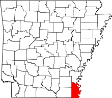 | |
| Unincorporated communities | ||
| Ghost town | ||
This article is issued from Wikipedia - version of the 5/8/2014. The text is available under the Creative Commons Attribution/Share Alike but additional terms may apply for the media files.