List of listed buildings in Coatbridge, North Lanarkshire
[This is a list of listed buildings in the parish of Coatbridge in North Lanarkshire, Scotland.
[== List ==]
| Name | Location | Date Listed | Grid Ref. [note 1] | Geo-coordinates | Notes | HB Number [note 2] | Image |
|---|---|---|---|---|---|---|---|
| Kirkshaws Road, Kirkstyle Cottages | 55°50′44″N 4°02′56″W / 55.845471°N 4.048882°W | Category B | 23017 | [[File: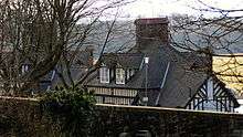 Kirkstyle Cottages | |||
| 59-65 (Odd Nos) Main Street And 1 Church Street | 55°51′46″N 4°01′37″W / 55.862686°N 4.02684°W | Category B | 23020 | 
| |||
| Graveyard | 55°50′42″N 4°02′59″W / 55.845088°N 4.049724°W | Category B | 22996 |
| |||
| Drumpellier Farm | 55°51′50″N 4°03′10″W / 55.863892°N 4.052745°W | Category B | 23000 |
| |||
| Central Station (Now Pullmans) K6 Telephone Kiosk | 55°51′45″N 4°01′53″W / 55.862541°N 4.031275°W | Category B | 23009 |
| |||
| Hozier Street, St Mary (Rc Church) Including Presbytery, Hall, Boundary Walls And Gatepiers | 55°51′10″N 4°01′19″W / 55.852729°N 4.021912°W | Category B | 49590 |
| |||
| Bank Street And Blair Road, Langloan Primary School With Boundary Walls, Gatepiers And Railings | 55°51′28″N 4°02′40″W / 55.85784°N 4.044372°W | Category C(S) | 49862 |
| |||
| 163 Bank Street, (Former Union Bank) Including Boundary Walls And Gatepiers | 55°51′35″N 4°02′12″W / 55.859602°N 4.036731°W | Category C(S) | 49869 |
| |||
| 1 Ross Street And 1 - 13 (Odd Nos) Bank Street | 55°51′42″N 4°01′52″W / 55.861608°N 4.031179°W | Category C(S) | 50160 |
| |||
| St Patrick's Roman Catholic Church, Including Walls, Piers, Gates And Fencing, Main Street, Coatbridge | 55°51′45″N 4°01′32″W / 55.86261°N 4.025462°W | Category B | 42895 |
| |||
| Coltswood Road, Greenhill Primary School, Including Boundary Walls, Railings And Gates | 55°52′09″N 4°01′29″W / 55.869131°N 4.024603°W | Category B | 23015 |
| |||
| 453 Main Street, Monklands District Magistrates Court | 55°51′35″N 4°00′34″W / 55.85981°N 4.009337°W | Category B | 23021 |
| |||
| School Street, Whifflet Primary School, Including Boundary Walls, Gatepiers, Railings And Gates | 55°51′02″N 4°01′21″W / 55.850668°N 4.02262°W | Category C(S) | 23022 |
| |||
| Weir Street, Dunbeth Church, Including Boundary Wall | 55°51′55″N 4°01′25″W / 55.865182°N 4.02371°W | Category B | 23023 |
| |||
| Muiryhall Street East, Former Coatdyke Parish Church, Including Hall, Boundary Walls And Gatepiers | 55°51′42″N 4°00′29″W / 55.861747°N 4.007951°W | Category C(S) | 23024 |
| |||
| Gartsherrie Parish Church | 55°51′52″N 4°01′37″W / 55.864439°N 4.02682°W | Category B | 22997 |
| |||
| St John Street St John The Evangelist Episcopal Church | 55°51′48″N 4°01′29″W / 55.863438°N 4.02485°W | Category C(S) | 23005 |
| |||
| 31 Muiryhall Street | 55°51′49″N 4°01′16″W / 55.863626°N 4.02104°W | Category C(S) | 23008 |
| |||
| Chisholm Street, K6 Telephone Kiosk | 55°52′11″N 4°01′09″W / 55.869627°N 4.019035°W | Category B | 23010 |
| |||
| Dundyvan Road, St Augustine (Rc Church) Including Sacristy, Presbytery, Hall, Boundary Walls And Gatepiers | 55°51′31″N 4°02′10″W / 55.858704°N 4.036156°W | Category B | 49591 |
| |||
| West Canal Street And Heritage Way, Former Caledonian Railway Station, With Gatepiers And Railings | 55°51′45″N 4°01′53″W / 55.862576°N 4.031341°W | Category C(S) | 49871 |
| |||
| West Lodge Drumpellier Park | 55°51′26″N 4°03′30″W / 55.857113°N 4.058315°W | Category B | 22998 |
| |||
| Dundyvan Church Henderson Street Oxford Street And Kirk Street | 55°51′28″N 4°01′59″W / 55.857714°N 4.032957°W | Category B | 23001 |
| |||
| Heritage Way, Summerlee Gatehouse Including Boundary Wall | 55°51′47″N 4°01′52″W / 55.862956°N 4.031201°W | Category C(S) | 49870 |
| |||
| Railway And Foot Bridge Over Former Monkland Canal (West Bridge) Including Access Stair Building | 55°51′43″N 4°01′54″W / 55.861934°N 4.031579°W | Category B | 49873 |
| |||
| 27, 29 Main Street, Coia's Building | 55°51′46″N 4°01′43″W / 55.862785°N 4.028492°W | Category C(S) | 23019 |
| |||
| Holy Trinity And All Saints Roman Catholic Church, Muiryhall Street East And Quarry Street | 55°51′41″N 4°00′22″W / 55.861406°N 4.006239°W | Category C(S) | 23004 |
| |||
| Lamberton's Engineering Works, Sunnyside Road And Russell Colt Street | 55°52′04″N 4°01′43″W / 55.867672°N 4.028603°W | Category B | 23011 |
| |||
| Academy Street, Carnegie Library, Including Boundary Wall And Gatepiers | 55°51′48″N 4°01′43″W / 55.863323°N 4.028552°W | Category B | 23012 |
| |||
| 51 Blairhill Street, Kenilworth House | 55°51′53″N 4°02′23″W / 55.864642°N 4.039584°W | Category B | 46093 |
| |||
| Old Monkland Church | 55°50′45″N 4°02′59″W / 55.845807°N 4.049746°W | Category B | 22995 | [[File: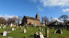 Old Monkland Church | |||
| Burial Place Of The Buchannans Of Drumpellier, West Lodge | 55°51′29″N 4°03′32″W / 55.858066°N 4.058845°W | Category B | 22999 |
| |||
| Gartsherrie Road, Sunnyside Station | 55°52′01″N 4°01′42″W / 55.866842°N 4.028272°W | Category B | 23003 |
| |||
| Calder Street/26 Bute Street, Calder Parish Church, Including Manse, Gatepiers And Railings | 55°51′06″N 4°01′04″W / 55.851788°N 4.017901°W | Category B | 23007 |
| |||
| Railway Bridge Over Coatbridge Cross | 55°51′44″N 4°01′48″W / 55.862196°N 4.029899°W | Category B | 49872 |
| |||
| Main Street, Whitelaw Memorial Fountain | 55°51′44″N 4°01′44″W / 55.86234°N 4.028756°W | Category C(S) | 50508 |
| |||
| 5 Carradale Road, Former Cattle Market, Including Lodge, Outbuilding, Gatepiers And Walls Facing West Canal Street, And Wall At Carradale Road | 55°51′41″N 4°02′04″W / 55.861446°N 4.034462°W | Category B | 23014 |
| |||
| Albert Street, Coatbridge High School, Including Gatepiers,_Boundary Walls And Railings | 55°51′56″N 4°01′26″W / 55.865612°N 4.023781°W | Category C(S) | 23013 |
| |||
| Dunbeth Road, Municipal Buildings, Including Boundary Walls,_Railings, Gatepiers And Gates | 55°51′50″N 4°01′19″W / 55.863838°N 4.021818°W | Category B | 23016 |
| |||
| Coats Church Jackson Street And Muiryhall Street | 55°51′47″N 4°01′09″W / 55.862957°N 4.019104°W | Category B | 23002 |
| |||
| Gartsherrie Road, Gartsherrie Primary School | 55°52′09″N 4°02′29″W / 55.869167°N 4.041451°W | Category C(S) | 49606 |
| |||
| Main Street, Airdrie Savings Bank | 55°51′45″N 4°01′45″W / 55.862513°N 4.029165°W | Category B | 23018 |
| |||
| Academy Street, Gartsherrie Academy Primary School Including Playground Walls | 55°51′50″N 4°01′40″W / 55.863873°N 4.027893°W | Category B | 23006 |
| |||
| Bank Street, Coatbridge War Memorial | 55°51′28″N 4°02′36″W / 55.857832°N 4.043221°W | Category C(S) | 50509 |
|
Key
The scheme for classifying buildings in Scotland is:
- Category A: "buildings of national or international importance, either architectural or historic, or fine little-altered examples of some particular period, style or building type."[1]
- Category B: "buildings of regional or more than local importance, or major examples of some particular period, style or building type which may have been altered."[1]
- Category C(S): "buildings of local importance, lesser examples of any period, style, or building type, as originally constructed or moderately altered; and simple traditional buildings which group well with others in categories A and B."[1]
There are approximately 47,400 listed buildings in Scotland. Of these, around 8 per cent (some 3,800) are Category A, and 51 per cent (24,000) are Category B, with the rest listed at Category C(s).[2]
See also
Notes
- ↑ Sometimes known as OSGB36, the grid reference (where provided) is based on the British national grid reference system used by the Ordnance Survey.
• "Guide to National Grid". Ordnance Survey. Retrieved 2007-12-12.
• "Get-a-map". Ordnance Survey. Retrieved 2007-12-17. - ↑ The "HB Number" is a unique number assigned to each listed building by Historic Scotland.
References
- All entries, addresses and coordinates are based on data from Historic Scotland. This data falls under the Open Government Licence
- 1 2 3 "What is Listing?". Historic Scotland. Retrieved 2010-07-06.
- ↑ Guide to the Protection of Scotland’s Listed Buildings (PDF). Historic Scotland. 2009. p. 17. ISBN 978-1-84917-013-0. Retrieved 2010-07-06.
This article is issued from Wikipedia - version of the 10/15/2016. The text is available under the Creative Commons Attribution/Share Alike but additional terms may apply for the media files.