List of listed buildings in Craignish, Argyll and Bute
This is a list of listed buildings in the parish of Craignish in Argyll and Bute, Scotland.
List
| Name | Location | Date Listed | Grid Ref. [note 1] | Geo-coordinates | Notes | HB Number [note 2] | Image |
|---|---|---|---|---|---|---|---|
| Ardfern Village, The Galley Of Lorne | 56°10′48″N 5°32′17″W / 56.180104°N 5.537953°W | Category C(S) | 4993 | 
| |||
| Ice-House, Near Lunga House | 56°12′00″N 5°33′20″W / 56.20006°N 5.555598°W | Category C(S) | 4995 |
| |||
| Kilbride Farmhouse Byre Range And Steading | 56°13′08″N 5°29′32″W / 56.21901°N 5.492357°W | Category B | 5004 |
| |||
| Barbreck Estate, Gothic Folly | 56°12′18″N 5°29′40″W / 56.205062°N 5.494362°W | Category B | 4997 |
| |||
| Kirkton Chapel (Kilmory) | 56°09′15″N 5°34′44″W / 56.15408°N 5.578924°W | Category B | 5001 | 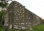
| |||
| Campbell Of Barbreck Mausoleum, Dunan Aula, ('The Tomb') Barbreck Estate | 56°12′21″N 5°29′36″W / 56.205881°N 5.493388°W | Category C(S) | 4999 |
| |||
| Former Craignish Manse, Ardfern Village | 56°10′48″N 5°32′27″W / 56.180037°N 5.540913°W | Category B | 4992 |
| |||
| Barbreck Bridge, Barbreck River | 56°11′37″N 5°30′15″W / 56.193547°N 5.50415°W | Category B | 4998 |
| |||
| Lunga House (Daill) | 56°11′59″N 5°33′20″W / 56.199668°N 5.555465°W | Category B | 4994 |
| |||
| Craignish Castle, Head Of Loch Beag | 56°09′19″N 5°35′23″W / 56.155163°N 5.589625°W | Category B | 5002 |
| |||
| Barbreck House | 56°12′02″N 5°29′54″W / 56.20065°N 5.498428°W | Category A | 4996 |
| |||
| Turnalt House | 56°12′54″N 5°28′58″W / 56.214963°N 5.48284°W | Category B | 5000 |
| |||
| Craignish Castle The Steading | 56°09′22″N 5°35′22″W / 56.15621°N 5.589497°W | Category B | 5003 |
| |||
| Craignish Parish Church, Ardfern Village | 56°10′46″N 5°32′22″W / 56.179347°N 5.539559°W | Category B | 4991 |
|
Key
The scheme for classifying buildings in Scotland is:
- Category A: "buildings of national or international importance, either architectural or historic, or fine little-altered examples of some particular period, style or building type."[1]
- Category B: "buildings of regional or more than local importance, or major examples of some particular period, style or building type which may have been altered."[1]
- Category C(S): "buildings of local importance, lesser examples of any period, style, or building type, as originally constructed or moderately altered; and simple traditional buildings which group well with others in categories A and B."[1]
There are approximately 47,400 listed buildings in Scotland. Of these, around 8 per cent (some 3,800) are Category A, and 51 per cent (24,000) are Category B, with the rest listed at Category C(s).[2]
See also
Notes
- ↑ Sometimes known as OSGB36, the grid reference (where provided) is based on the British national grid reference system used by the Ordnance Survey.
• "Guide to National Grid". Ordnance Survey. Retrieved 2007-12-12.
• "Get-a-map". Ordnance Survey. Retrieved 2007-12-17. - ↑ The "HB Number" is a unique number assigned to each listed building by Historic Scotland.
References
- All entries, addresses and coordinates are based on data from Historic Scotland. This data falls under the Open Government Licence
- 1 2 3 "What is Listing?". Historic Scotland. Retrieved 2010-07-06.
- ↑ Guide to the Protection of Scotland’s Listed Buildings (PDF). Historic Scotland. 2009. p. 17. ISBN 978-1-84917-013-0. Retrieved 2010-07-06.
This article is issued from Wikipedia - version of the 10/15/2016. The text is available under the Creative Commons Attribution/Share Alike but additional terms may apply for the media files.