Little Whernside
| Little Whernside | |
|---|---|
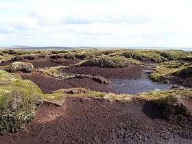 The summit of Little Whernside | |
| Highest point | |
| Elevation | 604 m (1,982 ft) |
| Parent peak | Great Whernside |
| Coordinates | 54°11′46″N 1°57′31″W / 54.196194°N 1.95849°WCoordinates: 54°11′46″N 1°57′31″W / 54.196194°N 1.95849°W |
| Geography | |
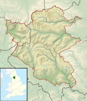 Little Whernside Yorkshire Dales, England | |
| OS grid | SE012768 |
| Topo map | OS Landranger 98 |
Little Whernside is a hill in the Yorkshire Dales, North Yorkshire, England, 2.5 miles (4.0 km) north east of Great Whernside. It is on the boundary between the Yorkshire Dales National Park and Nidderdale Area of Outstanding Natural Beauty, and forms the watershed between Coverdale and Nidderdale.
Little Whernside is on private land. Until 1997 no public right of way was established to the summit of Little Whernside, but in that year a public footpath was established along the ridge linking the summit to the summit of Great Whernside.[1] Following the Countryside and Rights of Way Act 2000 the hill became open access land. Little Whernside can be ascended from Scar House Reservoir.[2]
References
- ↑ Andrew Bibby (2006). Wharfedale and Nidderdale. Freedom to Roam Guides. Frances Lincoln. pp. 79–81. ISBN 0 7112 2553 2.
- ↑ "Walk 2:Great Whernside from Nidderdale". Open access walks. North Yorkshire County Council. Retrieved 10 April 2015.
External links
![]() Media related to Little Whernside at Wikimedia Commons
Media related to Little Whernside at Wikimedia Commons