Lowthorpe

Coordinates: 54°01′41″N 0°20′52″W / 54.028050°N 0.347821°W
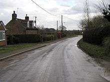
Lowthorpe is a village in the East Riding of Yorkshire, England. It is situated approximately 3 miles (5 km) north-east of Driffield town centre and 7 miles (11 km) south-west of Bridlington town centre.
It lies south-east of the A614 road and just north-west of the Yorkshire Coast railway line from Hull to Scarborough. Lowthorpe railway station served the village until it closed on 5 January 1970.[1]
Lowthorpe forms part of the civil parish of Harpham.
The church dedicated to St Martin was designated a Grade II* listed building in 1966 and is now recorded in the National Heritage List for England, maintained by Historic England.[2]
In 1823 Lowthorpe (then spelt 'Lowthorp'), was in the Wapentake of Dickering. The church and perpetual curacy was under the patronage of the St Quintin family. Population at the time was 149, with occupations including nine farmers, a linen manufacturer, a corn miller, and a rope maker. Residents included William Thomas St Quintin Esquire, of Lowthorp Hall, and a gentleman.[3]
References
- ↑ Butt, R. V. J. (1995). The Directory of Railway Stations: details every public and private passenger station, halt, platform and stopping place, past and present (1st ed.). Sparkford: Patrick Stephens Ltd. ISBN 1-8526-0508-1. OCLC 60251199.
- ↑ Historic England. "Church of St Martin (1346656)". National Heritage List for England. Retrieved 16 August 2013.
- ↑ Baines, Edward (1823). History, Directory and Gazetteer of the County of York. p. 364.
- Gazetteer — A–Z of Towns Villages and Hamlets. East Riding of Yorkshire Council. 2006. p. 8.
External links
 Media related to Lowthorpe at Wikimedia Commons
- Lowthorpe in the Domesday Book