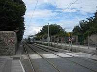
Green Line (Luas)
The Green Line (Irish: Líne Uaine) is one of the two lines of Dublin's Luas light rail system. The Green Line is currently entirely in the south side of Dublin city. It mostly follows the route of the old Harcourt Street railway line, which was reserved for possible re-use when it closed in 1958. The Red Line and Green Line are not yet connected to each other, with a 15-minute walk between the two closest points.
The Green Line from St Stephen's Green to Sandyford launched on 30 June 2004. An extension to Cherrywood (Brides Glen Station) was opened on 16 October 2010.
Differences from Old Harcourt Street Line
Between Harcourt Street and Charlemont, the Green Line takes a large loop east around buildings which didn't exist between 1859 and 1959. As such, there is no train bridge on Adelaide Road for the current line, as there had been for the Harcourt Street Line.
The line then follows the old alignment of the Harcourt Street line from Charlemont station as far as the current Sandyford stop (known as "Stillorgan" on the Harcourt Street line). After Sandyford the line detours over the Leopardstown Road/Brewery Road junction so as to run west around the Leopardstown Racecourse before rejoining the original alignment just north of Carrickmines.[1] The Harcourt Street line had run around the eastern edge of the racecourse, via Silverpark. Remnants of the old Foxrock Station are visible at the back of The Hedgerows in Foxrock.
After this detour around Leopardstown Racecourse, the current line runs roughly along the original alignment with some minor detours, particularly prevalent at Laughanstown.
There are some other cosmetic differences between the Harcourt Street Line and the current Green Line, such as the positioning of the Ranelagh stop. The location of Ranelagh on the former line was at the current Beechwood stop. The old Ranelagh stop was the last stop on the old line before the train reached the city.
Stops
| Image | Name Name in Irish |
Zone | Location | Transport interchange | Serves |
|---|---|---|---|---|---|
.jpg) |
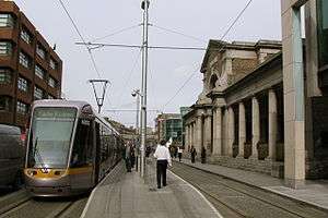
St. Stephen's Green Faiche Stiabhna |
Central 1 | St. Stephen's Green West 53°20′21″N 6°15′41″W / 53.339179°N 6.261350°W |
|
St. Stephen's Green, Grafton Street, Kildare Street Trinity College, Dublin Leinster House National Museum of Ireland – Archaeology National Library of Ireland Gaiety Theatre Bank of Ireland, College Green Royal College of Surgeons of Ireland Dublin Castle and Chester Beatty Library |
.jpg) |
Harcourt Sráid Fhearchair |
Central 1 | Harcourt Street 53°20′01″N 6°15′46″W / 53.333644°N 6.262734°W |
|
National Concert Hall Iveagh Gardens Synge Street CBS |
.jpg) |
Charlemont | Central 1 / Green 2 | Grand Parade 53°19′50″N 6°15′31″W / 53.330610°N 6.258630°W |
|
Portobello Cathal Brugha Barracks Grand Canal |
| Ranelagh Raghnallach |
Green 2 | Ranelagh 53°19′34″N 6°15′22″W / 53.326127°N 6.256212°W |
|
Ranelagh, Rathgar Leinster Cricket Club Fitzwilliam Lawn Tennis Club | |
.jpg) |
Beechwood Coill na Feá |
Green 2 | Dunville Avenue / Beechwood Road 53°19′15″N 6°15′17″W / 53.320924°N 6.254658°W |
|
Rathmines Sandford Park School |
 |
Cowper | Green 2 | Cowper Road 53°19′15″N 6°15′17″W / 53.320924°N 6.254658°W |
|
Gonzaga College Church of Ireland College of Education |
 |
Milltown Baile an Mhuilinn |
Green 2 | Richmond Avenue South 53°18′35″N 6°15′07″W / 53.309654°N 6.251807°W |
|
Milltown Golf Club Alexandra College |
.jpg) |
Windy Arbour Na Glasáin |
Green 2 | Churchtown Road Lower / St. Columbanus' Road 53°18′06″N 6°15′02″W / 53.301759°N 6.250675°W |
|
Windy Arbour, Churchtown, Clonskeagh Islamic Cultural Centre of Ireland De La Salle College Churchtown Central Mental Hospital |
.jpg) |
Dundrum Dún Droma |
Green 2/3 | Dundrum / Taney Road 53°17′33″N 6°14′42″W / 53.292424°N 6.245123°W |
|
Dundrum Dundrum Town Centre |
.jpg) |
Balally Baile Amhlaoibh |
Green 3 | Drummartin 53°17′10″N 6°14′12″W / 53.286030°N 6.236712°W |
Luas Park + Ride |
Goatstown Dundrum Town Centre Wesley College Mount Anville Secondary School |
 |
Kilmacud Cill Mochuda |
Green 3 | Benildus Avenue/Drummartin Link Road 53°16′59″N 6°13′27″W / 53.282948°N 6.224090°W |
|
Kilmacud St Benildus College |
 |
Stillorgan Stigh Lorgan |
Green 3 | Blackthorn Avenue 53°16′40″N 6°12′17″W / 53.277643°N 6.204595°W |
Luas Park + Ride |
Stillorgan Beacon Hospital |
 |
Sandyford Áth an Ghainimh |
Green 3/4 | Blackthorn Avenue 53°16′39″N 6°12′17″W / 53.277618°N 6.204634°W |
Luas Park + Ride |
Sandyford |
.jpg) |
Central Park An Pháirc Láir |
Green 4 | Sandyford Industrial Estate 53°16′12″N 6°12′14″W / 53.270099°N 6.203786°W |
|
Leopardstown Park Hospital Leopardstown Racecourse Kilmacud Crokes GAA |
.jpg) |
Glencairn Gleann an Chairn |
Green 4 | Murphystown Road 53°15′59″N 6°12′36″W / 53.266281°N 6.209923°W |
|
Glencairn House |
| The Gallops An Eachrais |
Green 4 | Murphystown Way 53°15′40″N 6°12′21″W / 53.261157°N 6.205870°W |
|
Stepaside | |
.jpg) |
Leopardstown Valley Gleann Baile na Lobhair |
Green 4 | Mayor Street Upper 53°15′30″N 6°11′54″W / 53.258316°N 6.198373°W |
|
|
| Ballyogan Wood Coill Bhaile Uí Ógáin |
Green 4 | Ballyogan Vale 53°15′18″N 6°11′04″W / 53.255078°N 6.184431°W |
|
Ballyogan | |
| Carrickmines Carraig Mhaighin |
Green 5 | Glenamuck Road North 53°15′16″N 6°10′18″W / 53.254350°N 6.171621°W |
Luas Park + Ride |
Carrickmines, Cabinteely | |
| Laughanstown Baile an Locháin |
Green 5 | Laughanstown (Lehaunstown) 53°15′02″N 6°09′18″W / 53.250636°N 6.154953°W |
|
||
.jpg) |
Cherrywood Coill na Sílíní |
Green 5 | Cherrywood Park / Valley Drive 53°14′43″N 6°08′45″W / 53.245382°N 6.145839°W |
|
Cherrywood, Cherrywood Business Park |
.jpg) |
Brides Glen Gleann Bhríde |
Green 5 | Cherrywood 53°14′31″N 6°08′34″W / 53.241870°N 6.142782°W |
|
St. Columcille's Hospital |
Luas Cross City
Luas Cross City (Irish: Luas Traschathrach) is a proposed extension to the Green Line, formerly called Luas BXD. It is planned to run from St. Stephen's Green to Broombridge railway station.[2]
Construction of Luas Cross City, an extension to the Green Line, began in June 2013 and is expected to open in 2017.[3] The Rosie Hackett Bridge carrying the new line over the river Liffey was opened on 20 May 2014.
The new section is planned to begin at the current city centre terminus, St. Stephen's Green, cross the Red Line near the Abbey stop, and continue northwards, terminating at Broombridge station. There it is expected to connect passengers using Irish Rail commuter services to Maynooth railway station and M3 Parkway railway station.
Stops
| Image | Name Name in Irish |
Zone | Branch | Location | Transport interchange | Serves |
|---|---|---|---|---|---|---|
| Dawson Street Sráid Dawson |
Southbound only | Dawson Street 53°20′29″N 6°15′29″W / 53.341516°N 6.258192°W |
||||
| Trinity Coláiste na Trionóide |
Southbound only | College Street 53°20′44″N 6°15′29″E / 53.345455°N 6.258085°E |
||||
| Westmoreland Street Sráid Westmoreland |
Northbound only | Westmoreland Street 53°20′46″N 6°15′33″E / 53.346070°N 6.259072°E |
||||
| O'Connell Street — GPO Sráid Uí Chonaill — AOP |
Northbound only | O'Connell Street South 53°20′59″N 6°15′37″W / 53.349625°N 6.260295°W |
||||
| O'Connell Street Upper Sráid Uí Chonaill Thuaidh |
Northbound only | O'Connell Street North 53°21′06″N 6°15′40″W / 53.351572°N 6.261067°W |
||||
| Parnell Sráid Uí Phairnéil |
Southbound only | Parnell Street East 53°21′11″N 6°15′38″W / 53.352993°N 6.260424°W |
||||
| Marlborough | Southbound only | Marlborough Street South 53°20′59″N 6°15′29″W / 53.349843°N 6.258149°W |
||||
| Dominick | Main line | Dominick Street Lower 53°21′05″N 6°15′56″W / 53.351386°N 6.265649°W |
||||
| Broadstone — DIT An Clochán Leathan — ITBÁC |
Main line | Western Way 53°21′16″N 6°16′23″W / 53.354517°N 6.272976°W |
||||
| DIT Campus — Grangegorman Campais ITBÁC — Gráinseach Ghormáin |
Main line | Grangegorman 53°21′28″N 6°16′39″W / 53.357700°N 6.277520°W |
||||
| Phibsborough Baile Phib |
Main line | Phibsborough 53°21′37″N 6°16′48″W / 53.360235°N 6.279945°W |
||||
| Cabra Cabrach |
Main line | Mount Bernard Park 53°21′51″N 6°16′54″W / 53.364200°N 6.281745°W |
||||
| Broombridge Droichead Broome |
Main line | Broombridge railway station 53°22′22″N 6°17′56″W / 53.372684°N 6.298975°W |
||||

See also
References
- ↑ "Ordnance Survey Ireland". OSI. Retrieved 20 November 2014.
- ↑
- ↑ "Green light given to Luas link-up, first passengers 2017". RTÉ. Retrieved 5 August 2012.
External links
| Wikimedia Commons has media related to LUAS tram system. |