Luzit
| Luzit | |
|---|---|
 | |
  Luzit | |
| Coordinates: 31°41′5.63″N 34°53′11.39″E / 31.6848972°N 34.8864972°ECoordinates: 31°41′5.63″N 34°53′11.39″E / 31.6848972°N 34.8864972°E | |
| District | Jerusalem |
| Council | Mateh Yehuda |
| Affiliation | Moshavim Movement |
| Founded | 1955 |
| Founded by | North African Jews |
| Population (2015)[1] | 653 |
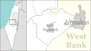
Luzit (Hebrew: לוּזִית, lit. Almond Tree) is a moshav in central Israel. Located between Beit Shemesh and Kiryat Gat, it falls under the jurisdiction of Mateh Yehuda Regional Council. In 2015 it had a population of 653.
History
The village was established in 1955 by immigrants from North Africa, and was initially named Dir Duban Bet after the depopulated Arab village of Deir al-Dubban. It was later renamed Luzit after almond trees, which are common in the area.
References
- ↑ "List of localities, in Alphabetical order" (PDF). Israel Central Bureau of Statistics. Retrieved 16 October 2016.
This article is issued from Wikipedia - version of the 9/9/2016. The text is available under the Creative Commons Attribution/Share Alike but additional terms may apply for the media files.