Lweeza
| Lweeza | |
|---|---|
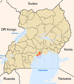
 Lweeza Map of Uganda showing the location of Lweeza | |
| Coordinates: 00°13′17″N 32°33′09″E / 0.22139°N 32.55250°E | |
| Country |
|
| Region | Central Region |
| County | Kaddondo |
| Constituency | Kyaddondo South |
| Government | |
| • MP | Issa Kikungwe |
| Elevation | 1,180 m (3,870 ft) |
| Time zone | EAT 0°13'17.0"N 32°33'09.0"E (UTC+3) |
Lweeza, sometimes spelled as Lweza, is a neighborhood in the Central Region of Uganda. The correct phonetic spelling consistent with the local Ganda language is Lweeza.
Location
The neighborhood is located in the newly created municipality of Ssabagabo.[1][2] Lweeza is bounded by Lubowa to the north, Murchison Bay (a part of Lake Victoria), to the east and south, and Kajjansi to the west. This location is approximately 30 kilometres (19 mi), by road, north of Entebbe International Airport, Uganda's largest civilian and military airport,[3] and approximately 13 kilometres (8.1 mi), by road, south of Kampala, the capital and largest city of Uganda.[4] The coordinates of Lweeza are 0°13'17.0"N, 32°33'09.0"E (Latitude:0.221391; Longitude:32.552506).[5]
Points of interest
The following points of interest are located in the neighborhood:
- Mildmay Centre - A facility that treats and provides vocational training for HIV/AIDS victims. The centre was built by and is administered with assistance from the government of the United Kingdom.[6]
- The Kampala-Entebbe road
- Roofings Limited, a member of the Roofings Group
See also
References
- ↑ Moses Mulondo, Moses Walubiri, and David Lumu (14 August 2015). "12 new municipalities created". New Vision. Kampala. Retrieved 16 March 2016.
- ↑ NTVU (9 August 2015). "What is the implication of approving 11 new municipalities?". Kampala: Nation Television Uganda (NTVU). Retrieved 16 March 2016.
- ↑ GFC (16 March 2016). "Distance between Entebbe International Airport, Entebbe, Central Region, Uganda and Lweza Conference Center, Kyadondo, Central Region, Uganda". Globefeed.com (GFC). Retrieved 16 March 2016.
- ↑ GFC (16 March 2016). "Distance between Kampala Road, Kampala, Central Region, Uganda and Lweza Conference Center, Kyadondo, Central Region, Uganda". Globefeed.com (GFC). Retrieved 16 March 2016.
- ↑ Google (16 March 2016). "Location of Lweeza, Ssabagabo Municipality, Wakiso District, Central Uganda" (Map). Google Maps. Google. Retrieved 16 March 2016.
- ↑ Vision Reporter (29 September 2015). "About Mildmay Uganda". New Vision. Kampala. Retrieved 16 March 2016.
External links
Coordinates: 00°12′36″N 32°35′06″E / 0.21000°N 32.58500°E