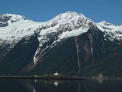
Lynn Canal Highway

The Lynn Canal Highway, or Juneau Access Road, is a proposed road between Skagway and City and Borough of Juneau, the capitol of the U.S. state of Alaska. Such a road, if built, would still require ferry access to connect Juneau to the Alaskan highway network. The new road would be 47.9 miles long, built at a cost of $574 million,[1] and be a part of the Alaska Route 7. The current preferred plan of the Alaska Department of Transportation & Public Facilities (DOT&PF) calls for extending "The Road" northward from Juneau to a ferry terminal 18 miles south of Skagway.[2] The corridor crosses Berners Bay LUD II which is a congressionally designated roadless area created by the Tongass Timber Reform Act (TTRA). The act permits crossing LUD IIs when the governor of the State of Alaska designates routes as essential transportation corridors. The proposed road skirts the shore of a northwestern section of Alaska's Inside Passage, which was recently named a National Scenic Waterway.
History
Juneau has been served by the Alaska Marine Highway ferry system since 1959. In 1987, citing "more than 15 years" of project work, Alaska senator Jim Duncan won federal funding to study nine options that would provide road or road/ferry access to Juneau. The previous year's Southeast Transportation Plan had cited prices ranging from $231.5 million to $440 million, with annual costs from $2.1 million to $12 million, depending mostly on the length of the road.[3]
Starting in the early 1990s, the Alaska Department of Transportation & Public Facilities (DOT&PF) initiated the Juneau Access Improvements Project, intended to improve surface access between Juneau and communities further north. Because of the proposed routing, DOT&PF needed to obtain approvals and permits from several federal agencies and obtain an environmental impact statement. A draft of this report was issued in 1997 followed by a period of public comment and analysis. This process was halted in 2000 by former governor Tony Knowles due to the high costs of the project. The next governor, Frank Murkowski, ordered the completion of the environmental impact statement in 2002, resulting in a supplemental draft EIS in January 2005 which was finalized in January 2006.
Alignment along the preferred route incurred a loss of 70 acres of wetlands, 68 acres of old-growth forest, the possibility of up to a 26% reduction in the brown bear habitat, and disturbances to bald eagle nesting territory. The report was disputed by the Southeast Alaska Conservation Council, who claimed that the report violated several federal environmental acts by failing to propose improvements to the existing ferry system, and DOT&PF intervened as a defendant. In 2009, the court ordered the environmental impact statement to be rewritten. The state lost its options to appeal the ruling and in 2011 began work on a new draft supplemental environmental impact statement (SEIS), which was completed in September, 2014.[2] The public comment period on the SEIS, originally set to close on November 10, 2014, was extended until November 25, 2014.[2]
Proposed alignment
The preferred route selected by the DOT&PF would be constructed according to Alternative 2B, as outlined in the environmental impact statement. This option includes 47.9 miles of new highway along the east shore of the Lynn Canal, to run from Echo Cove (at the current terminus of the Glacier Highway) to a new ferry terminal (at 59°13′N 135°19′W / 59.217°N 135.317°W) at the mouth of the Katzehin River, along Chilkoot Inlet. Ferry service from the Katzehin terminal would extend to Haines, on the opposite bank of Chilkoot Inlet, as well as Skagway, approximately 18 miles to the north.[4]
See also
References
- ↑ Brehmer, Elwood (2014-09-25). "Ketchikan wins ferries; Juneau road EIS released". Alaska Journal of Commerce. Retrieved 2014-11-16.
- 1 2 3 "Juneau Access Improvements". Alaska Dept. of Transportation & Public Facilities. Retrieved 16 November 2014.
- ↑ Kleeschulte, Chuck (8 June 1987). "Haines-to-Juneau road to be studied". Juneau Empire. Juneau, United States.
- ↑ "Alternative 2B (preferred): East Lynn Canal Highway to Katzehin with Shuttles to Haines and Skagway" (PDF). Alaska Dept. of Transportation & Public Facilities. Retrieved 16 November 2014.
General references
- The Juneau Empire - The Divided Line
- Tongass National Forest Supplemental Environmental Impact Statement
External links
- Juneau Access Improvements (by Alaska Department of Transportation)
- 2014 SEIS Figures
- Juneau Road (an anti road lobbyist site)