Mangotsfield
| Mangotsfield | |
 Mangotsfield |
|
| Population | 12,439 (2011 Census)[1] |
|---|---|
| OS grid reference | ST641780 |
| Civil parish | Mangotsfield Rural |
| Unitary authority | South Gloucestershire |
| Ceremonial county | Gloucestershire |
| Region | South West |
| Country | England |
| Sovereign state | United Kingdom |
| Post town | Bristol |
| Postcode district | BS16 |
| Dialling code | 0117 |
| Police | Avon and Somerset |
| Fire | Avon |
| Ambulance | South Western |
| EU Parliament | South West England |
| UK Parliament | Kingswood |
|
|
Coordinates: 51°29′N 2°29′W / 51.48°N 2.49°W
Mangotsfield is an urban area in the unitary authority of South Gloucestershire, in North-East Bristol.
The village was mentioned in the Domesday Book in 1086 as Manegodesfelle,[2] and as Manegodesfeld in 1377.[3]
Sport and leisure

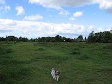
Rodway Hill, Mangotsfield.
Mangotsfield is the home of Mangotsfield United F.C. and Cleve R.F.C. Rodway Hill is a favourite spot for dog walkers and the starting point of many pigeon races.[4]
Education and schools
There is one secondary school in Mangotsfield: Mangotsfield School (A Specialist College in Engineering and Science).
References
- ↑ "Parish population 2011.Retrieved 19 March 2015".
- ↑ See National Archives Cat Ref: E31/2/1
- ↑ Plea Rolls of the Court of Common Pleas; National Archives; CP40/466. Year 1377; Edward III ; http://aalt.law.uh.edu/AALT4/E3/CP40no466/aCP40no466fronts/IMG_0047.htm; third entry. the (smudged) first word in the second line & also in the third line
- ↑ http://www.rpra.org/lib_sites.htm
This article is issued from Wikipedia - version of the 11/29/2016. The text is available under the Creative Commons Attribution/Share Alike but additional terms may apply for the media files.