Maraussan
| Maraussan | ||
|---|---|---|
|
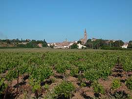
A view of old Maraussan | ||
| ||
 Maraussan | ||
|
Location within Occitanie region  Maraussan | ||
| Coordinates: 43°22′03″N 3°09′31″E / 43.3675°N 3.1586°ECoordinates: 43°22′03″N 3°09′31″E / 43.3675°N 3.1586°E | ||
| Country | France | |
| Region | Occitanie | |
| Department | Hérault | |
| Arrondissement | Béziers | |
| Canton | Béziers-3 | |
| Intercommunality | Domitienne | |
| Government | ||
| • Mayor (2008–2014) | Serge Pesce | |
| Area1 | 12.37 km2 (4.78 sq mi) | |
| Population (2008)2 | 3,448 | |
| • Density | 280/km2 (720/sq mi) | |
| Time zone | CET (UTC+1) | |
| • Summer (DST) | CEST (UTC+2) | |
| INSEE/Postal code | 34148 / 34370 | |
| Elevation |
8–92 m (26–302 ft) (avg. 38 m or 125 ft) | |
|
1 French Land Register data, which excludes lakes, ponds, glaciers > 1 km² (0.386 sq mi or 247 acres) and river estuaries. 2 Population without double counting: residents of multiple communes (e.g., students and military personnel) only counted once. | ||
.svg.png)
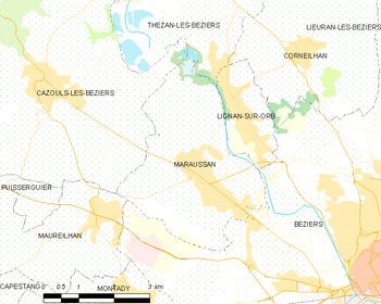
Maraussan is a commune in the Hérault department in southern France.
It lies approximately 8 km northwest of Béziers, on route D14 ( Av de Béziers ), a busy route for commuters to Béziers.
Chateau Perdiguier lies just outside the town on the cross road D39 (Route de Tarbaka) leading down to the river Orb.
Map
Population
| Historical population | ||
|---|---|---|
| Year | Pop. | ±% |
| 1962 | 1,595 | — |
| 1968 | 1,655 | +3.8% |
| 1975 | 2,088 | +26.2% |
| 1982 | 2,154 | +3.2% |
| 1990 | 2,336 | +8.4% |
| 1999 | 2,782 | +19.1% |
| 2008 | 3,448 | +23.9% |
See also
References
| Wikimedia Commons has media related to Maraussan. |
This article is issued from Wikipedia - version of the 2/11/2016. The text is available under the Creative Commons Attribution/Share Alike but additional terms may apply for the media files.