Massachusetts Route 43
| ||||
|---|---|---|---|---|
 | ||||
| Route information | ||||
| Length: | 15.67 mi[1] (25.22 km) | |||
| Existed: | ca. 1932 – present | |||
| Major junctions | ||||
| South end: |
| |||
|
| ||||
| North end: |
| |||
| Location | ||||
| Counties: | Berkshire | |||
| Highway system | ||||
| ||||

Route 43 is the extension of New York State Route 43 into Massachusetts. Unlike the route it continues, which is signed east-west, Massachusetts Route 43 is a north-south route.
Route description

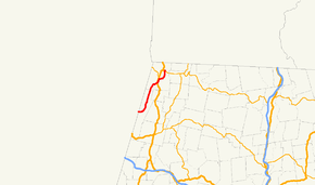
Massachusetts Route 43 begins at the eastern end of New York State Route 43 in Hancock. It turns northward through the Kinderhook Creek valley in the Taconic Mountains, passing near Jiminy Peak, and passing through the northern half of Hancock before entering Williamstown. In Williamstown, the road continues north-northeastward, and crosses U.S. Route 7 in the southern part of town. After crossing U.S. 7, the road turns right onto Green River Road, which follows its namesake (a tributary of the Hoosac River) around the south and east sides of Stone Hill, before ending at Route 2 just east of the Williams College campus.
Major intersections
The entire route is in Berkshire County.
| Location | mi | km | Destinations | Notes | |
|---|---|---|---|---|---|
| Hancock | 0.00 | 0.00 | Continuation into New York | ||
| Williamstown | 10.9 | 17.5 | |||
| 15.67 | 25.22 | ||||
| 1.000 mi = 1.609 km; 1.000 km = 0.621 mi | |||||
References
| Wikimedia Commons has media related to Massachusetts Route 43. |