Mississippi Highway 3
For other uses, see MS 3 (disambiguation).
| ||||
|---|---|---|---|---|
| Route information | ||||
| Maintained by MDOT | ||||
| Length: | 119.401 mi[1] (192.157 km) | |||
| Major junctions | ||||
| South end: |
| |||
|
| ||||
| East end: |
| |||
| Location | ||||
| Counties: | DeSoto, Tunica, Tate, Panola, Quitman, Tallahatchie, Sunflower, Yazoo, Warren | |||
| Highway system | ||||
| ||||
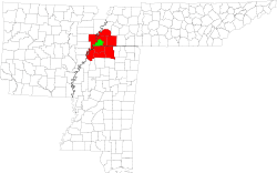
Mississippi Highway 3 runs north–south from Newport to U.S. Route 49W near Inverness. For part of its duration, MS 3 is a concurrency with US 49 West. It travels approximately 119 miles (192 km), serving DeSoto, Tunica, Tate, Panola, Quitman, Tallahatchie, Sunflower, Yazoo, and Warren counties.
Locales on route
From north to south
Major intersections
| County | Location | mi | km | Destinations | Notes | ||
|---|---|---|---|---|---|---|---|
| Warren | Redwood | interchange | |||||
| Yazoo | | ||||||
| Yazoo City | interchange | ||||||
| interchange; south end of US 49W overlap | |||||||
| interchange; north end of US 49W overlap | |||||||
| Gap in route | |||||||
| Sunflower | | ||||||
| | |||||||
| | |||||||
| Gap in route | |||||||
| Tallahatchie | Tutwiler | ||||||
| Quitman | | south end of MS 322 overlap | |||||
| Lambert | north end of MS 322 overlap | ||||||
| Marks | |||||||
| Sledge | |||||||
| Panola | Crenshaw | ||||||
| Tate | | south end of MS 4 overlap | |||||
| Tunica | | north end of MS 4 overlap | |||||
| Banks | proposed MS 713 | ||||||
| DeSoto | | interchange | |||||
| | |||||||
| 1.000 mi = 1.609 km; 1.000 km = 0.621 mi | |||||||
See also
![]() Mississippi portal
Mississippi portal
![]() U.S. Roads portal
U.S. Roads portal
References
- ↑ "Mississippi Public Roads Selected Statistics" (PDF). Mississippi Department of Transportation. 2008. Retrieved 2010-06-03.
This article is issued from Wikipedia - version of the 1/18/2015. The text is available under the Creative Commons Attribution/Share Alike but additional terms may apply for the media files.

