Moel Llyfnant
| Moel Llyfnant | |
|---|---|
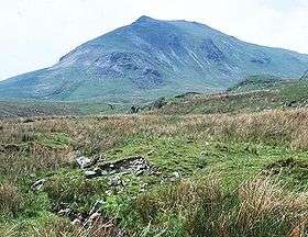 Moel Llyfnant from the Ffestiniog road | |
| Highest point | |
| Elevation | 751 m (2,464 ft) |
| Prominence | 206 m (676 ft) |
| Parent peak | Arenig Fawr |
| Listing | Marilyn, Hewitt, Nuttall |
| Geography | |
| Location | Gwynedd, Wales |
| Parent range | Snowdonia |
| OS grid | SH827370 |
| Topo map | OS Landranger 124 |
| Listed summits of Moel Llyfnant | ||||
| Name | Grid ref | Height | Status | |
|---|---|---|---|---|
| Gallt y Daren | 619 m (2,031 ft) | Hewitt, Nuttall | ||
Moel Llyfnant is a mountain in the southern portion of the Snowdonia National Park in Gwynedd, Wales. It is a peak in the Arenig mountain range. It lies to the west of Arenig Fawr. It has one notable top, the twin peaked Gallt y Daren, being at the end of its west ridge.
The summit area has rocky outcrops, on top of one lies the small cairn that marks the summit. The views of Arenig Fawr are excellent, while to the south Rhobell Fawr and Dduallt can be observed, and to the west Gallt y Daren and Foel Boeth.[1]
References
- ↑ Nuttall, John & Anne (1999). The Mountains of England & Wales - Volume 1: Wales (2nd edition ed.). Milnthorpe, Cumbria: Cicerone. ISBN 1-85284-304-7.
External links
Coordinates: 52°54′03″N 3°46′23″W / 52.90083°N 3.77306°W
This article is issued from Wikipedia - version of the 1/24/2016. The text is available under the Creative Commons Attribution/Share Alike but additional terms may apply for the media files.