Moergestel
| Moergestel | ||
|---|---|---|
| ||
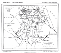 Moergestel in 1867 | ||
| Coordinates: 51°33′0″N 5°11′0″E / 51.55000°N 5.18333°E | ||
| Country | Netherlands | |
| Province | North Brabant | |
| Municipality | Oisterwijk | |
| Population (2008) | 5.959 | |
Moergestel is a village in the Dutch province of North Brabant. It is located in the municipality of Oisterwijk, about 7 km East of Tilburg.
Moergestel was a separate municipality until 1997, when it became part of Oisterwijk.[1]
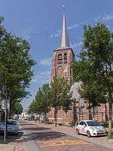
Church: de Sint Janskerk
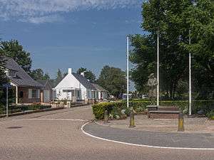
Statue general C.M. Barber
References
- ↑ Ad van der Meer and Onno Boonstra, Repertorium van Nederlandse gemeenten, KNAW, 2006.
External links
- J. Kuyper, Gemeente Atlas van Nederland, 1865-1870, "Moergestel". Map of the former municipality, around 1868.
Coordinates: 51°33′N 5°11′E / 51.550°N 5.183°E
This article is issued from Wikipedia - version of the 1/29/2016. The text is available under the Creative Commons Attribution/Share Alike but additional terms may apply for the media files.