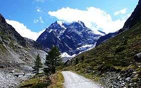
Mont Collon
| Mont Collon | |
|---|---|
|
The north face of Mont Collon from the Arolla valley | |
| Highest point | |
| Elevation | 3,637 m (11,932 ft) |
| Prominence | 208 m (682 ft) [1] |
| Parent peak | L'Evêque |
| Coordinates | 45°58′35″N 7°30′17″E / 45.97639°N 7.50472°ECoordinates: 45°58′35″N 7°30′17″E / 45.97639°N 7.50472°E |
| Geography | |
 Mont Collon Location in Switzerland | |
| Location | Valais, Switzerland |
| Parent range | Pennine Alps |
| Climbing | |
| First ascent | 31 July 1867 by George Edward Foster, Hans Baumann and Johann Kronig[2] |
Mont Collon (3,637 m) is a mountain of the Swiss Pennine Alps in the canton of Valais. Its glaciated north face dominates the view south from the village of Arolla.
The ascent over the West Ridge, first made by A. Cust and F. Gardiner with the guides Peter Knubel and Johannes Knubel of St. Niklaus in the canton Valais on 3 August 1876, is now the normal route.
References
- ↑ Retrieved from the Swisstopo topographic maps. The key col is located south of the mountain at 3,429 metres.
- ↑ Note on first ascent by Foster, The Alpine Journal, Volume 4, 1868, Page 56
External links
| Wikimedia Commons has media related to Mont Collon. |
This article is issued from Wikipedia - version of the 10/12/2016. The text is available under the Creative Commons Attribution/Share Alike but additional terms may apply for the media files.
