Montoro Inferiore
| Montoro Inferiore (former municipality) | |
|---|---|
| Comune | |
| Comune di Montoro Inferiore | |
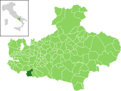
 Montoro Inferiore within the Province of Avellino | |
 Montoro Inferiore (former municipality) Location of Montoro Inferiore | |
| Coordinates: 40°49′N 14°46′E / 40.817°N 14.767°ECoordinates: 40°49′N 14°46′E / 40.817°N 14.767°E | |
| Country | Italy |
| Region | Campania |
| Province / Metropolitan city | Avellino (AV) |
| Frazioni | Borgo, Figlioli, Misciano, Piano,[1] Piazza di Pandola, Preturo, San Bartolomeo, San Felice |
| Area | |
| • Total | 19 km2 (7 sq mi) |
| Elevation | 190 m (620 ft) |
| Population (1 May 2009)[2] | |
| • Total | 10,380 |
| • Density | 550/km2 (1,400/sq mi) |
| Demonym(s) | Montoresi |
| Time zone | CET (UTC+1) |
| • Summer (DST) | CEST (UTC+2) |
| Postal code | 83025 |
| Dialing code | 0825 |
| Patron saint | St. Nicholas of Tolentino |
| Saint day | 10 September |
| Website | Official website |
Montoro Inferiore was a town and comune (municipality) in the province of Avellino, Campania, Italy.
History
Following a referendum, the municipality was officially disestablished on 3 December 2013; after being merged, with Montoro Superiore, in the new municipality of Montoro.[3]
Geography
Montoro Inferiore bordered with Bracigliano (SA), Contrada, Fisciano (SA), Forino, Mercato San Severino (SA) and Montoro Superiore.
It was formed by 8 hamlets (frazioni): Borgo, Figlioli, Misciano, Piano (municipal seat, sometimes named Montoro), Piazza di Pandola, Preturo, San Bartolomeo and San Felice.
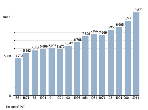
Demographics

Personalities
- Giuseppe De Falco (1908-1955), politician
See also
References
- ↑ Municipal seat
- ↑ All demographics and other statistics from the Italian statistical institute (Istat); Dati - Popolazione residente all'1/5/2009
- ↑ (Italian) Italian Regional Law no. 16, 11 November 2013
External links
| Wikimedia Commons has media related to Montoro Inferiore. |
- (Italian) Montoro Inferiore official website
- (Italian) Montoro (new municipality) official website
This article is issued from Wikipedia - version of the 2/10/2016. The text is available under the Creative Commons Attribution/Share Alike but additional terms may apply for the media files.