Monts du Lyonnais
The Monts du Lyonnais are a range of low-altitude mountains and eastern foothills of the Massif Central located in the Loire and Rhône departments in France.
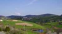
Typical landscape of the Monts du Lyonnais
Geography
The monts du Lyonnais' highest summit is the crêt Malherbe (934m).
The Janon river running east from Terrenoire (now part of Saint-Étienne) and then the Gier continuing east from Saint-Chamond to meet the Rhone at Givors create a valley in the coal basin that separates Mont Pilat from the Monts du Lyonnais.[1]
References
Citations
- ↑ Gruner 1857, p. 58.
Sources
- Gruner, Louis (1857). Description géologique et minéralogique du département de la Loire. Imprimerie impériale. Retrieved 2013-08-19.
Coordinates: 45°39′N 4°32′E / 45.650°N 4.533°E
This article is issued from Wikipedia - version of the 10/16/2016. The text is available under the Creative Commons Attribution/Share Alike but additional terms may apply for the media files.