Morcolla District
| Morcolla | |
|---|---|
| District | |
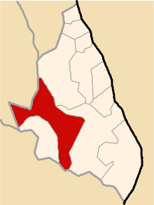 Location of Morcolla in the Sucre province | |
| Country |
|
| Region | Ayacucho |
| Province | Sucre |
| Founded | December 21, 1956 |
| Capital | Morcolla |
| Subdivisions | 31 populated places |
| Area | |
| • Total | 289.34 km2 (111.71 sq mi) |
| Elevation | 3,459 m (11,348 ft) |
| Population (2005 census) | |
| • Total | 2,190 |
| • Density | 7.6/km2 (20/sq mi) |
| Time zone | PET (UTC-5) |
| UBIGEO | 050906 |
Morcolla is one of 11 districts of the Sucre Province in the Ayacucho region in Peru.
Population
The population of Morcolla is 2,190 people, 1,088 men and 1,102 women.[1]
Ethnic groups
The people in the district are mainly indigenous citizens of Quechua descent. Quechua is the language which the majority of the population (85.58%) learnt to speak in childhood, 14.22% of the residents started speaking using the Spanish language (2007 Peru Census).[2]
Administrative division
The populated places in the district are:[1]
|
|
|
See also
References
- 1 2 INEI
- ↑ inei.gob.pe INEI, Peru, Censos Nacionales 2007, Frequencias: Preguntas de Población: Idioma o lengua con el que aprendió hablar (in Spanish)
| |
|---|---|
| Cangallo | |
| Huamanga | |
| Huanca Sancos | |
| Huanta | |
| La Mar | |
| Lucanas | |
| Parinacochas | |
| Paucar del Sara Sara | |
| Sucre | |
| Víctor Fajardo | |
| Vilcas Huamán | |
Coordinates: 14°41′38″S 74°07′27″W / 14.69389°S 74.12417°W
This article is issued from Wikipedia - version of the 4/6/2015. The text is available under the Creative Commons Attribution/Share Alike but additional terms may apply for the media files.