Mount Albert (Quebec)
| Mont Albert | |
|---|---|
 | |
| Highest point | |
| Elevation | 1,151 m (3,776 ft) [1] |
| Prominence | 740m[2] |
| Listing |
Quebec 1000 meter peaks List of mountains in Canada |
| Coordinates | 48°55′17″N 66°11′42″W / 48.9214°N 66.19495°WCoordinates: 48°55′17″N 66°11′42″W / 48.9214°N 66.19495°W |
| Geography | |
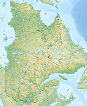  Mont Albert Location in Quebec | |
| Location | Mont-Albert, Quebec, Canada |
| Parent range | Chic-Choc Mountains |
| Climbing | |
| First ascent | August 26, 1845 by Alexander Murray |
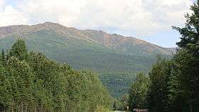
Mont Albert is a mountain in the Chic-Choc range in the Gaspésie National Park in the Gaspé Peninsula of eastern Quebec, Canada. At 1,151 m (3,776 ft),[1] it is one of the highest mountains in southern Quebec, and is popular for hiking.
Mount Albert was named in honor of Prince Albert of Saxe-Coburg and Gotha, husband of Queen Victoria, because geologist Alexander Murray made the first recorded ascent of the mountain on the Prince's birthday, 26 Aug. 1845.[1]
Geography
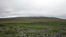
The summit of Mount Albert is a plateau 13 km (8.08 mi) across called La Table à Moïse, or Moses's Table.[3] It includes two summits, Albert North (1,070 m (3,510 ft))[4] and Albert South (1,151–1,154 m (3,776–3,786 ft)).[1][5] Each of the summits is situated at either side of the plateau.
The principal component of Mont Albert is an unusual kind of bedrock called serpentine; this originated as oceanic crust and was then uplifted during the formation of the Appalachian Mountains about 480 million years ago.[3] The nearly flat serpentine tableland on the mountain's summit is an alpine tundra area above the tree line, and supports a quite distinctive flora with many kinds of endemic and highly disjunct plants.[6]
The ascent of Mount Albert from near sea level is challenging, but popular with hikers, offering a view of the St. Lawrence and the Côte-Nord, the river's north shore, part of the ancient bedrock of the Canadian Shield.
References
- 1 2 3 4 Gouvernement du Québec (2011). "Mont Albert" (in French). Commission de toponymie. Retrieved 4 Jan 2011.
- ↑ "Mont Albert, Québec". Peakbagger.com. 1 Nov 2004. Retrieved 2 Sep 2011.
- 1 2 Marie-José Auclair. "Un vaste plateau orangé: le mont Albert" (in French). Géoplein Air. Retrieved 15 Aug 2011.
- ↑ "Sommet Albert Nord". Banque de noms de lieux du Québec (in French). Commission de toponymie. Retrieved 15 August 2011.
- ↑ "Sommet Albert Sud". Banque de noms de lieux du Québec (in French). Commission de toponymie. Retrieved 15 August 2011.
- ↑ Scoggan, H.J. (1950). The Flora of Bic and the Gaspé Peninsula, Quebec. Ottawa, Canada: National Museum of Canada. p. 399.