Mount Hood National Forest
| Mount Hood National Forest | |
|---|---|
|
IUCN category VI (protected area with sustainable use of natural resources) | |
|
Snow-covered Mount Hood in the Mount Hood National Forest | |
 | |
| Location | Oregon, USA |
| Nearest city | Government Camp, Oregon |
| Coordinates | 45°22′14″N 121°42′14″W / 45.37056°N 121.70389°WCoordinates: 45°22′14″N 121°42′14″W / 45.37056°N 121.70389°W |
| Area | 1,071,466 acres (4,336 km2)[1] |
| Established | July 1, 1908[2] |
| Visitors | 4.4 million[3] (in 2006) |
| Governing body | U.S. Forest Service |
| Website | Mount Hood National Forest |


_(photograph_by_Theo%2C_2006).jpg)
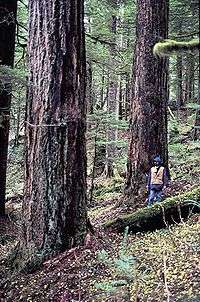
The Mount Hood National Forest is 62 miles (100 km) east of the city of Portland, Oregon, and the northern Willamette River valley. The Forest extends south from the Columbia River Gorge across more than 60 miles (97 km) of forested mountains, lakes and streams to the Olallie Scenic Area, a high lake basin under the slopes of Mount Jefferson. The Forest includes and is named after Mount Hood, a stratovolcano. The Forest encompasses some 1,067,043 acres (4,318.17 km2).[4] Forest headquarters are located in Sandy, Oregon. A 1993 Forest Service study estimated that the extent of old growth in the Forest was 345,300 acres (139,700 ha).[5] The Forest is divided into four separate districts - Barlow (with offices in Dufur), Clackamas River (Estacada), Hood River (Mount Hood-Parkdale), and Zigzag (Zigzag).
In descending order of land area the National Forest is located in parts of Clackamas, Hood River, Wasco, Multnomah, Marion, and Jefferson counties.[6]
History
Mount Hood National Forest was first established as the Bull Run Forest Reserve in 1892. It was merged with part of Cascade National Forest on July 1, 1908 and named Oregon National Forest. The name was changed again to Mount Hood National Forest in 1924.[7]
In 2010, Mount Hood National Forest was honored with its own quarter under the America the Beautiful Quarters program.[8]
Recreation
The Mount Hood National Forest is one of the most-visited National Forests in the United States, with over four million visitors annually. Less than five percent of the visitors camp in the forest. The forest contains 170 developed recreation sites, including:[3][4][9]
- Timberline Lodge, built in 1937 high on Mount Hood
- Lost Lake
- Burnt Lake
- Trillium Lake
- Timothy Lake
- Rock Creek Reservoir
- The Old Oregon Trail, including Barlow Road
Other common recreational activities in the Mount Hood National Forest include fishing, boating, hiking, hunting, rafting, horseback riding, skiing, mountain biking, berry-picking, and mushroom collecting.[4] A portion of the Pacific Crest Trail passes through the National Forest on the flanks of the mountain. Mount Hood is a popular destination for mountain climbers.
Several nonprofits lead free hikes into the National Forest to build support for further protection from logging and off-road vehicle use, including BARK[10] and Oregon Wild.[11]
Mount Hood National Recreation Area was established within Mount Hood National Forest on March 30, 2009. The recreation area comprises three separate units.[12]
Wilderness
There are eight officially designated wilderness areas within Mount Hood National Forest collectively adding up to 311,448 acres that are part of the National Wilderness Preservation System. Acreages are as of 2011.[13]
- Badger Creek Wilderness at 29,057 acres (118 km2)
- Bull of the Woods Wilderness at 36,731 acres (149 km2)
- Clackamas Wilderness at 9,181 acres (37 km2)
- Lower White River Wilderness at 1,743 acres (7 km2) not counting 1,063 acres (4 km2) on BLM land
- Mark O. Hatfield Wilderness at 65,822 acres (266 km2)
- Mount Hood Wilderness at 63,177 acres (256 km2) includes the peak and upper slopes of Mount Hood
- Roaring River Wilderness at 36,768 acres (149 km2)
- Salmon–Huckleberry Wilderness at 62,455 acres (253 km2)
The Olallie Scenic Area is a lightly roaded lake basin that also offers a primitive recreational experience.[4]
References
- ↑ "Land Areas of the National Forest System" (PDF). U.S. Forest Service. January 2012. Retrieved June 30, 2012.
- ↑ "The National Forests of the United States" (PDF). ForestHistory.org. Retrieved July 30, 2012.
- 1 2 Revised Visitation Estimates - National Forest Service
- 1 2 3 4 "About Us". Mt. Hood National Forest. U.S. Forest Service. Retrieved 2007-09-06.
- ↑ Bolsinger, Charles L.; Waddell, Karen L. (1993). "Area of old-growth forests in California, Oregon, and Washington" (PDF). United States Forest Service, Pacific Northwest Research Station. Resource Bulletin PNW-RB-197.
- ↑ Table 6 - NFS Acreage by State, Congressional District and County - United States Forest Service - September 30, 2007
- ↑ Davis, Richard C. (September 29, 2005). "National Forests of the United States" (pdf). The Forest History Society.
- ↑ "Mount Hood Quarter Introduced". United States Mint.
- ↑ Michael Milstein (September 20, 2007). "Rethinking camping—A Forest Service plan could dramatically change Mount Hood's offerings". OregonLive.com. The Oregonian. Retrieved 2007-10-06.
- ↑ Bark Abouts - BARK
- ↑ Hikes & Events - Oregon Wild
- ↑ "Mount Hood National Recreation Area, Oregon". Public Lands Information Center. Retrieved March 9, 2012.
- ↑ Wilderness Data Search, Wilderness.net website
External links
| Wikimedia Commons has media related to Mount Hood National Forest. |
- Mount Hood National Forest - US Forest Service
- Mount Hood National Forest - Wildernet.com
- Hiking Mount Hood National Forest - GORP
