Mount Yajuro
| Mount Yajuro | |
|---|---|
| 弥十郎ヶ嶽 | |
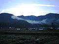 Mount Yajuro from Hahakabemae Bus Stop | |
| Highest point | |
| Elevation | 715.1 m (2,346 ft) |
| Listing | List of mountains and hills of Japan by height |
| Coordinates | 35°3′N 135°18′E / 35.050°N 135.300°E |
| Naming | |
| Pronunciation | [jadʑuɽoɡatake] |
| Geography | |
| Location | Sasayama, Hyōgo, Japan |
| Parent range | Tanba Highland |
| Geology | |
| Mountain type | fault-block |
Mount Yajuro (弥十郎ヶ嶽 Yajūrō-ga-take) is a 715.1 m (2,346 ft) mountain of Tanba Highland, located in Sasayama, Hyōgo, Japan. This mountain is one of Hyōgo 50 mountains. This mountain is a part of Inagawa Natural Park.
Outline
Mount Yajuro is one of the popular mountains of Tanba Highland. Mount Yajuro is a typical fault-block mountain in this area.
Religion
Mount Yajuro has been an object of worship by the people around the mountain. On the south foot of the mountain, there was Saiko-ji temple which is said to be established in 731 by Gyōki. The temple moved to the north foot of the mountain, but burned in the war. On the north foot of the mountain there is Hahakabe shrine and today we can find a monument to show the shrine has their own area in the mountain.
Route
There are several routes to the top of the mountain. The easiest route is from Hōkabemae Bus Stop of Shinki Bus via Yakushinogahara Camping place. It takes about two hours. Another route is from Ushiroguchi Bus Stop, it takes one and half hours. The other route is from Shimo-Kagonobo..
Access
- Hōkabemae Bus Stop of Shinki Bus
- Ushiroguchi Bus Stop of Shinnki Bus
- Shimo-Kagonobo Bus Stop of Shinki Bus
Gallery
- Mount Yajuro from Hahakabe Shrine (12/2008)
 The top of Mount Yajuro with snow (12/2008)
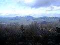 Taki Mountains from the top of Mount Yajuro (12/2008)
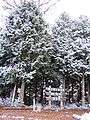
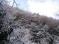 Frost on trees near the top of Mount Yajuro (12/2008)
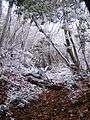 A climbing route to the top of Mount Yajuro covered snow(12/2008)
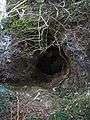 Yamakasa Yajuro Cave in the middle of Mount Yajuro (12/2008)
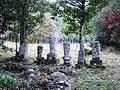 Ruins of Saiko-ji temple (12/2008)
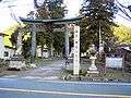 Hahakabe Shrine (12/2008)
References
- Hokusetsu, Kyoto Nishiyama, Shobunsha, 2007
- Official Home Page of the Geographical Survey Institute in Japan