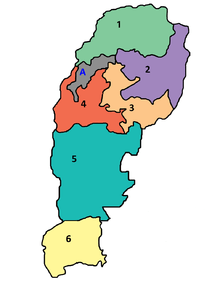
Multan Division
Multan Division was an administrative division of Punjab Province, Pakistan, until the reforms of 2000 abolished the third tier of government.
At abolition it contained the following districts:[1]
| District | Area (km²) | Population 1998 |
|---|---|---|
| Multan | 3,721 | 3,116,851 |
| Vehari | 4,373 | 2,090,416 |
| Khanewal | 4,349 | 2,068,490 |
| Lodhran | 1,790 | 1,171,800 |
| Total | 14,233 | 8,477,557 |
History
Multan Division was created during the British colonial rule in the South Asia. The division lay between 28°25' and 33°13 N and 69°19' and 73°39 E, the Sutlej divided it from Bahawalpur on the south-east, while the Indus flowed partly through the Division and partly along its border to the west. The headquarters of the Commissioner were at Multan (or in the hot season, at Fort Munro). The Division was abolished in 1884, but reconstituted in 1901. According to the 1881 census of India the population of the area now included was 2,036,956, in 1891 it had risen to 2,277,605, and in 1901 to 3,014,675. The total area was 29,520 square miles (76,500 km2), the division was composed of the following districts:[2]
| District | Area (km²) | Population 1901 |
|---|---|---|
| Multan | 15,817 | 710,626 |
| Mianwali | 20,243 | 424,588 |
| Jhang | 17,229 | 1,002,656 |
| Muzaffargarh | 9,415 | 405,656 |
| Dera Ghazi Khan | 13,742 | 471,149 |
| Total | 76,446 | 3,014,675 |
References
- ↑ Divisions/Districts of Pakistan
Note: Although divisions as an administrative structure has been abolished, the election commission of Pakistan still groups districts under the division names - ↑ Multan Division - Imperial Gazetteer of India, v. 18, p. 22.
Coordinates: 30°00′N 71°40′E / 30.000°N 71.667°E
