N10 road (South Africa)
| ||||
|---|---|---|---|---|
_with_labels.svg.png) | ||||
|
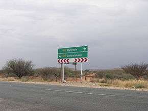
The N10 in the Northern Cape | ||||
| Route information | ||||
| Maintained by SANRAL | ||||
| Major junctions | ||||
| Northwest end: | B3 at the Namibian border at Nakop | |||
|
| ||||
| Southeast end: |
| |||
| Location | ||||
| Major cities: | Upington, De Aar, Cradock | |||
| Highway system | ||||
|
Numbered routes of South Africa
| ||||

The N10 is a national route in South Africa which connects Port Elizabeth on the Eastern Cape coast with the Namibian border at Nakop, via Cradock, De Aar and Upington.[1]
Route
The N10 begins at Nakop on the Namibian border; on the Namibian side the road is known as the B3. It runs east to Upington in the Northern Cape, where it crosses the Orange River, and then south-east through Prieska and De Aar. At Middelburg it enters the Eastern Cape, and continues south through Cradock to end at the N2 between Port Elizabeth and Grahamstown.
References
- ↑ Falkner, John (May 2012). South African Numbered Route Description and Destination Analysis (Report). National Department of Transport. p. 24. Retrieved 12 August 2014.
External links
| Wikimedia Commons has media related to N10 road (South Africa). |

Coordinates: 28°24′46″S 21°11′11″E / 28.412691°S 21.186361°E
This article is issued from Wikipedia - version of the 8/13/2014. The text is available under the Creative Commons Attribution/Share Alike but additional terms may apply for the media files.