Noachis Terra
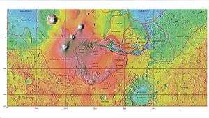
MOLA map showing boundaries with other regions
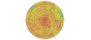
MOLA map showing boundaries with other regions around the south pole of Mars
Noachis Terra (lit. "Land of Noah") is an extensive southern landmass (terra) of the planet Mars. It lies west of the giant Hellas impact basin, roughly between the latitudes −20° and −80° and longitudes 30° west and 30° east, centered on 45°S 350°E / 45°S 350°ECoordinates: 45°S 350°E / 45°S 350°E. It is in the Noachis quadrangle.
The term "Noachian epoch" is derived from this region.
Gallery

 Crater that was buried in another age and is now being exposed by erosion, as seen by the Mars Global Surveyor, under the MOC Public Targeting Program.
 Floor of crater in Noachis quadrangle, as seen by HiRISE under HiWish program.
 Erosion forms on floor of crater, as seen by HiRISE under HiWish program
 Context for image of dark dunes in next image. Picture taken with Mars Global surveyor under MOC Public Targeting Program.
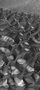 Dark dunes (probably basalt), in an intracrater dune field, Noachis. Picture from Mars Global Surveyor, under the MOC Public Targeting Program.
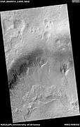 Wide view of gullies in Arkhangelsky Crater, as seen by HiRISE under HiWish program
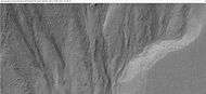 Close-up of small channels in gullies in Arkhangelsky Crater, as seen by HiRISE under HiWish program Patterned ground in the shape of polygons can be seen to the right. Note: this is an enlargement of the previous image from Arkhangelsky Crater.
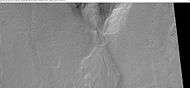 Close-up of a gully showing a channel going across the apron, as seen by HiRISE under HiWish program. Note: this is an enlargement of a previous image from Arkhangelsky Crater.
Interactive Mars map
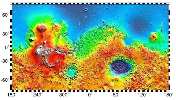
Interactive imagemap of the global topography of Mars. Hover your mouse to see the names of over 25 prominent geographic features, and click to link to them. Coloring of the base map indicates relative elevations, based on data from the Mars Orbiter Laser Altimeter on NASA's Mars Global Surveyor. Reds and pinks are higher elevation (+3 km to +8 km); yellow is 0 km; greens and blues are lower elevation (down to −8 km). Whites (>+12 km) and browns (>+8 km) are the highest elevations. Axes are latitude and longitude; Poles are not shown.
(also see: Mars Rovers map) (view • discuss)
Recommended reading
- Lorenz, R. 2014. The Dune Whisperers. The Planetary Report: 34, 1, 8-14
- Lorenz, R., J. Zimbelman. 2014. Dune Worlds: How Windblown Sand Shapes Planetary Landscapes. Springer Praxis Books / Geophysical Sciences.
External links
This article is issued from Wikipedia - version of the 11/25/2016. The text is available under the Creative Commons Attribution/Share Alike but additional terms may apply for the media files.