Norman Bird Sanctuary
|
Smith-Gardiner-Norman Farm Historic District | |
 | |
  | |
| Location | 583 Third Beach Rd., Middletown, Rhode Island |
|---|---|
| Area | 129 acres (52 ha) |
| Built | 1750 |
| Architectural style | Federal, Colonial Revival |
| NRHP Reference # | 08000234[1] |
| Added to NRHP | June 16, 2008 |
The Norman Bird Sanctuary is a 325-acre (1.32 km2) bird sanctuary, nature preserve, and museum at 583 Third Beach Road in Middletown, Rhode Island overlooking the Atlantic Ocean.
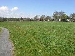
In 1949 the Norman Bird Sanctuary was founded through a bequest in the will of Mabel Norman Cerio. The Sanctuary comprises the largest area of preserved open space in Newport County. There are 325 acres and 7 miles of hiking trails. The refuge contains hay fields, woodlands and ridges overlooking the ocean and ponds. Hanging Rock, prominent local landmark, is located within the sanctuary overlooking the ocean. There is also a Visitor's Center and gift shop, and a 19th Century Barn Museum featuring displays about the wildlife for children and adults.[2]
History
The property of the Norman Bird Sanctuary has an agricultural history dating to the early 18th century, when a large tract of land was purchased by Isaac Smith, a descendant of one of the area's first settlers. The main farmhouse on the property is a typical Colonial-era farmhouse, five bays wide with a large central chimney, and dates to about 1755. The property, then 200 acres (81 ha), was auctioned to pay debts in 1782; the purchaser was Benjamin Gardiner. In 1898 George Norman, a Newport businessman, purchased the farm, then reduced to about 129 acres (52 ha), and it was his daughter Mabel who modernized the house and gave it a more Colonial Revival appearance.[3] This core portion of the sanctuary was listed on the National Register of Historic Places in 2008.[1]
Gallery


 View from Hanging Rock
 View from Hanging Rock
See also
- List of museums in Rhode Island
- Sachuest Point National Wildlife Refuge
- National Register of Historic Places listings in Newport County, Rhode Island
References
- 1 2 National Park Service (2010-07-09). "National Register Information System". National Register of Historic Places. National Park Service.
- ↑ http://www.normanbirdsanctuary.org/ (May 18, 2010)
- ↑ "NRHP nomination for Smith-Gardiner-Norman Farm Historic District" (PDF). Rhode Island Preservation. Retrieved 2014-10-20.
External links
Coordinates: 41°29′58.2″N 71°15′3.5″W / 41.499500°N 71.250972°W