Norway Bight
South Orkney Islands.
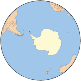
Norway Bight (60°37′S 45°49′W / 60.617°S 45.817°WCoordinates: 60°37′S 45°49′W / 60.617°S 45.817°W) is a bay 4 nautical miles (7 km) wide indenting the south coast of Coronation Island between Meier Point and Mansfield Point, in the South Orkney Islands. The name appears on a chart by Petter Sorlle, Norwegian whaling captain who made a running survey of the South Orkney Islands in 1912-13.
![]() This article incorporates public domain material from the United States Geological Survey document "Norway Bight" (content from the Geographic Names Information System).
This article incorporates public domain material from the United States Geological Survey document "Norway Bight" (content from the Geographic Names Information System).
This article is issued from Wikipedia - version of the 12/18/2015. The text is available under the Creative Commons Attribution/Share Alike but additional terms may apply for the media files.