Old Harbor Reservation Parkways
|
Old Harbor Reservation Parkways, Metropolitan Park System of Greater Boston | |
 | |
  | |
| Location | Boston, Massachusetts |
|---|---|
| Coordinates | 42°19′46″N 71°2′45″W / 42.32944°N 71.04583°WCoordinates: 42°19′46″N 71°2′45″W / 42.32944°N 71.04583°W |
| Area | 55.8 acres (22.6 ha) |
| Built | 1893 |
| Architect |
Frederick Law Olmsted Arthur A. Schurcliff |
| MPS | Metropolitan Park System of Greater Boston MPS |
| NRHP Reference # | [1] |
| Added to NRHP | July 24, 2008 |
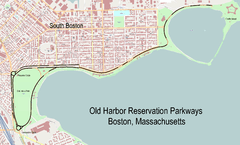
The Old Harbor Reservation Parkways are three historic roads in the Old Harbor area of Boston. They are part of the Boston parkway system designed by Frederick Law Olmsted. They include[2]
- all of William J. Day Boulevard, running from Castle Island to Kosciuszko Circle[3] along Pleasure Bay and the Old Harbor shore.
- the part of Columbia Road from its northeastern end at Farragut Road west to Pacuska Circle[4] (formerly called Preble Circle). This section of road runs quite close to Day Boulevard for much of its length, diverging to form the northern boundary of Joe Moakley Park (formerly called Columbus Park). A discontiguous segment of Columbia Road running southwest from Kosciuszko Circle into Dorchester is not part of the parkway system.
- the part of Old Colony Avenue from its southern end near Kosciuszko Circle, northward to Pacuska Circle. This section of road forms the western border of Joe Moakley Park. Old Colony Avenue north of Pacuska Circle is not part of the parkway system.
These roadways follow the southern shoreline of South Boston west from Castle Island, and surround what is now known as Joe Moakley Park. The southernmost point of these roadways is Kosckiuszko Circle. The roadways were added to the National Register of Historic Places on July 24, 2008.
See also
References
| Wikimedia Commons has media related to Old Harbor Reservation Parkways. |
- ↑ National Park Service (2009-03-13). "National Register Information System". National Register of Historic Places. National Park Service.
- ↑ "National Register nomination for Old Harbor Reservation Parkways". Commonwealth of Massachusetts. Retrieved 2013-11-19.
- ↑ Statue in center of the circle, identified on some maps.
- ↑ Plaque in the center of the circle, not identified on maps.
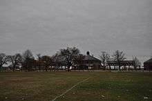
Moakley Park, Day Boulevard, and the McCormack Bath House
| Topics | 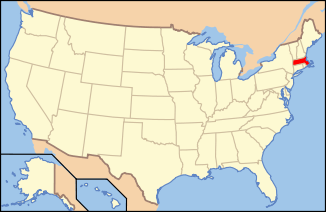 | ||||||||||||||||||||||||||||||
|---|---|---|---|---|---|---|---|---|---|---|---|---|---|---|---|---|---|---|---|---|---|---|---|---|---|---|---|---|---|---|---|
| Lists by county | |||||||||||||||||||||||||||||||
| Lists by city |
| ||||||||||||||||||||||||||||||
| Other lists | |||||||||||||||||||||||||||||||
| |||||||||||||||||||||||||||||||
This article is issued from Wikipedia - version of the 11/28/2016. The text is available under the Creative Commons Attribution/Share Alike but additional terms may apply for the media files.