Ontario Highway 503
Highway 503 was a provincial secondary highway in Ontario, Canada, that existed between 1956 and 1998.[1] Between 1956 and 1963, the highway stretched from Kirkfield to Sebright, and then along the Monck Road from Sebright to Kinmount, entirely within Victoria County. In 1964, the route was extended to Highway 121 in Tory Hill along the route of Highway 500, which was removed from the network. Its total distance of 116.8 kilometres (72.6 mi)[2] was downloaded to the various counties in which it resided. Today the road exists as:
 City Road 6 and
  City Road 45 in the city of Kawartha Lakes
- County Road 503 in the county of Peterborough
- County Road 503 in the county of Haliburton
Kawartha Lakes Road 45
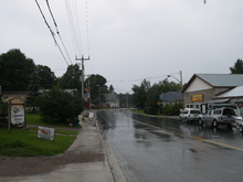
Kawartha Lakes Road 45 (also known as Monck Road) is a municipally-maintained class-3 roadway[3] located in the city of Kawartha Lakes, in the Canadian province of Ontario. The road crosses the entire city from west to east, passing through several unincorporated villages along the way, Sebright, Uphill, Norland, Dongola and Kinmount. The road runs in a predominantly east–west direction and covers a distance of 50.0 kilometres (31.1 mi),[4][5] primarily rural geography.[4] Its western terminus is Kirkfield Road (Kawartha Lakes Road 6), and its eastern terminus is the Bobcaygeon Road.[5]
Prior to 1 January 1998, the Kawartha Lakes Road 45 in its entirety was designated as Secondary Highway 503. Highway 503 was commissioned in 1956,[6] loosely following the Monck Road colonization road.
Major intersections
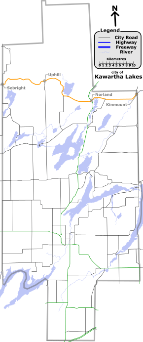
(Click to enlarge)
The following table lists the major junctions along Highway 503, as noted by the Ministry of Transportation of Ontario.[4] This table is based on 1989 data.
| Division | Location | km[4] | mi | Destinations | Notes |
|---|---|---|---|---|---|
| Kawartha Lakes | Sebright | 0.0 | 0.0 | Western terminus of Kawartha Lakes Road 45, road continues west as County Road 45 | |
| Uphill | 15.3 | 9.5 | Victoria Road historic colonization trail | ||
| 25.6 | 15.9 | ||||
| Norland | 34.6 | 21.5 | |||
| Dongola | 39.7 | 24.7 | |||
| Kinmount | 49.7– 49.9 | 30.9– 31.0 | Concurrent with City Road 121 for 0.2 kilometres.[7] Formerly Highway 121 | ||
| 49.9 | 31.0 | End of concurrency with Kawartha Lakes Road 121 | |||
| 50.0 | 31.1 | Bobcaygeon Road | Bobcaygeon historic colonization trail. Eastern terminus of Kawartha Lakes Road 45, road continues east as Peterborough County Road 503 | ||
| 1.000 mi = 1.609 km; 1.000 km = 0.621 mi | |||||
References
- ↑ http://www.thekingshighway.ca/MAPS/Hwy503map.htm
- ↑ http://www.thekingshighway.ca/Hwy503.htm
- ↑ city of Kawartha Lakes, Kawartha Lakes winter maintenance priorities schedule (PDF), retrieved 2009-10-11
- 1 2 3 4 Google Maps - Kawartha Lakes Road 45 (length and route), retrieved 2009-11-02
- 1 2 Muskoka and the Kawartha's, 1999 edition road map, MapArt, 1999
- ↑ History of Ontario Highway 503, retrieved 2009-11-09
- ↑ Google (November 3, 2009). "Google Maps - Kawartha Lakes Roads 45 and 121 (length and route of concurrency)" (Map). Google Maps. Google.