Opmeer
| Opmeer | |||
|---|---|---|---|
| Municipality | |||
|
Church in Spanbroek | |||
| |||
.svg.png) Location in North Holland | |||
| Coordinates: 52°42′N 4°57′E / 52.700°N 4.950°ECoordinates: 52°42′N 4°57′E / 52.700°N 4.950°E | |||
| Country | Netherlands | ||
| Province | North Holland | ||
| Government[1] | |||
| • Body | Municipal council | ||
| • Mayor | GertJan Nijpels (VVD) | ||
| Area[2] | |||
| • Total | 41.94 km2 (16.19 sq mi) | ||
| • Land | 41.57 km2 (16.05 sq mi) | ||
| • Water | 0.37 km2 (0.14 sq mi) | ||
| Elevation[3] | 0 m (0 ft) | ||
| Population (May 2014)[4] | |||
| • Total | 11,310 | ||
| • Density | 272/km2 (700/sq mi) | ||
| Demonym(s) | Opmeerder | ||
| Time zone | CET (UTC+1) | ||
| • Summer (DST) | CEST (UTC+2) | ||
| Postcode | 1660–1663, 1715–1719 | ||
| Area code | 0226, 0229 | ||
| Website |
www | ||
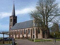
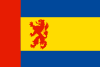
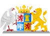
Opmeer ( pronunciation )(West Frisian: Opmar or Obmar) is a municipality and town in the Netherlands, in the province of North Holland and the region of West-Frisia.
Population centres
The municipality of Opmeer consists of the following cities, towns, villages and/or districts: Aartswoud, De Weere, Gouwe, Hoogwoud, Opmeer, Spanbroek, Wadway, Zandwerven.
Topography
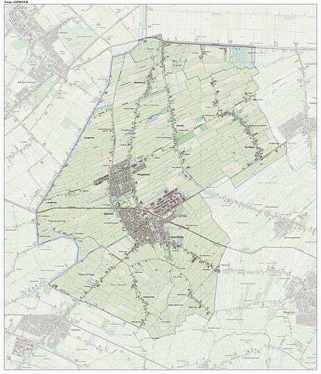
Dutch Topographic map of the municipality of Opmeer, June 2015
Local government
The municipal council of Opmeer consists of 15 seats, which are divided as follows:
The CDA and the Gemeentebelangen Opmeer are in a coalition government.
The town has an online portal with information on services and news.[5]
References
- ↑ "college van Burgemeester en Wethouders" [Board of mayor and aldermen] (in Dutch). Gemeente Opmeer. Retrieved 20 March 2014.
- ↑ "Kerncijfers wijken en buurten" [Key figures for neighbourhoods]. CBS Statline (in Dutch). CBS. 2 July 2013. Retrieved 12 March 2014.
- ↑ "Postcodetool for 1716VS". Actueel Hoogtebestand Nederland (in Dutch). Het Waterschapshuis. Retrieved 20 March 2014.
- ↑ "Bevolkingsontwikkeling; regio per maand" [Population growth; regions per month]. CBS Statline (in Dutch). CBS. 26 June 2014. Retrieved 24 July 2014.
- ↑ "Opmeer".
External links
 Media related to Opmeer at Wikimedia Commons
- Official website
 |
Hollands Kroon | | ||
| Hollands Kroon |  |
Medemblik | ||
| ||||
 | ||||
| Heerhugowaard | Koggenland |


This article is issued from Wikipedia - version of the 6/4/2016. The text is available under the Creative Commons Attribution/Share Alike but additional terms may apply for the media files.