Palitana State
| Palitana State પાલીતાણા રિયાસત | |||||
| Princely State of British India | |||||
| |||||
 | |||||
| History | |||||
| • | Established | 1194 | |||
| • | Indian independence | 1948 | |||
| Area | |||||
| • | 1921 | 777 km2 (300 sq mi) | |||
| Population | |||||
| • | 1921 | 58,000 | |||
| Density | 74.6 /km2 (193.3 /sq mi) | ||||
 This article incorporates text from a publication now in the public domain: Chisholm, Hugh, ed. (1911). "article name needed". Encyclopædia Britannica (11th ed.). Cambridge University Press. This article incorporates text from a publication now in the public domain: Chisholm, Hugh, ed. (1911). "article name needed". Encyclopædia Britannica (11th ed.). Cambridge University Press. | |||||
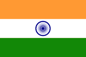

Palitana was a princely state in India during the British Raj until 1948. The center was the city of Palitana. The last ruler of the state received a privy purse of 180,000 Rupees at the state's accession to independent India on 15 February 1948.
History
As a "Second Class" princely state it was founded in 1194. It was one of the major states in Saurashtra, where there were many smaller states. Palitana covered 777 km² and had 58,000 inhabitants (in 1921) in 91 villages, generating a 744,416 Rs revenue. In 1940 it had a population of 76,432.[1]
It used to be a native state of India in the Kathiawar Agency of the Bombay Presidency. Area, 289 sq. m.; pop. (1901), 52,856, showing a decrease of 15% in the decade. Gross revenue, £42,000; tribute jointly to the Gaekwar of Baroda and the Nawab of Junagadh, £700. The capital of the state, Palitana, had a population of 12,800. Its ruler enjoyed a 9-guns salute.[2]
Rulers
The rulers were Gohil Rajputs, with the title of Thakur Sahib.[3]
- 1697 - 1734 Prithvirajji Kandhaji
- 1734 - .... Nonghanji III
- .... - 1766 Sartanji II
- 1766 - 1770 Alubhai
- 1770 - 1820 Undaji
- 1820 - 1840 Kandhaji IV
- 1840 - 1860 Nonghanji IV
- 1860 Pratapsinghji (d. 1860)
- 1 Jun 1860 - Nov 1885 Sursinhji (b. 1844 - d. 1885)
- 24 Nov 1885 - 29 Aug 1905 Mansinhji Sursinhji (b. 1863 - d. 1905) (from 1 Jan 1896, Sir Mansinhji Sursinhji)
- 29 Sep 1905 - 15 Aug 1947 Bahadursinhji Mansinhji (b. 1900 - d. 1964) (from 1 Jan 1930, Sir Bahadursinhji Mansinhji; personal style Maharaja from 1944)
See also
References
- ↑ - Rajput Provinces of India - Palitana State (Princely State)
- ↑ Columbia-Lippincott Gazeteer p. 1417.
- ↑ Princely States of India
Coordinates: 28°31′N 71°50′E / 28.52°N 71.83°E