Pashuk Glacier
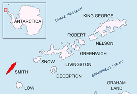

Pashuk Glacier (Bulgarian: ледник Пашук, ‘Lednik Pashuk’ \'led-nik pa-'shuk\) is the steep 2.7 km long and 600 m wide glacier on the southeast side of Imeon Range, Smith Island in the South Shetland Islands, Antarctica, which is draining southeastwards from Vakarel Saddle between the side ridges descending from Antim Peak and Evlogi Peak and separating it from Krivodol Glacier to the north and Rupite Glacier to the south respectively, and flows into Osmar Strait southwest of Sredets Point.
The glacier is named after the Canadian Keri Pashuk, skipper of the sailing yacht Northanger which provided logistic support for the first ascent of the island’s summit Mount Foster (2105 m) in 1996.
Location
Pashuk Glacier is centred at 62°59′45″S 62°30′00″W / 62.99583°S 62.50000°WCoordinates: 62°59′45″S 62°30′00″W / 62.99583°S 62.50000°W. Bulgarian mapping in 2009.
Maps
- L.L. Ivanov. Antarctica: Livingston Island and Greenwich, Robert, Snow and Smith Islands. Scale 1:120000 topographic map. Troyan: Manfred Wörner Foundation, 2009. ISBN 978-954-92032-6-4
References
- Bulgarian Antarctic Gazetteer. Antarctic Place-names Commission. (details in Bulgarian, basic data in English)
- SCAR Composite Gazetteer of Antarctica.
This article includes information from the Antarctic Place-names Commission of Bulgaria which is used with permission.