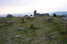
Penwithick
Coordinates: 50°22′23″N 4°46′48″W / 50.373°N 4.780°W

Penwithick (Cornish: Pennwydhek) or Penwithick Stents[1] is a village in Cornwall, England, United Kingdom. It is situated 2.5 miles (4.0 km) north of St Austell,[2] in the civil parish of Treverbyn in the 'clay country' area of china clay quarrying. Whilst falling in a different civil parish Penwithick does have an electoral ward in its own name. The population at the census 2011 was 4,479[3]
Penwithick has a small local shop which also has a sub post office, a social club as well as a premises selling fish & chips.
There are plans to build a new settlement Baal & West Carclaze south of the village as part of the St Austell and Clay Country Eco-town. This would include 1,800 to 2,500 homes. The plan was given outline approval in July 2009.[4]
References
- ↑ Ordnance Survey One-inch Map of Great Britain; Bodmin and Launceston, sheet 186. 1961.
- ↑ Ordnance Survey: Landranger map sheet 200 Newquay & Bodmin ISBN 978-0-319-22938-5
- ↑ "Ward population 2011 census.Retrieved 11 Feb 2015".
- ↑ "Baal & West Carclaze – a community for all". ECO-BOS. Retrieved 7 November 2010.
![]() Media related to Penwithick at Wikimedia Commons
Media related to Penwithick at Wikimedia Commons