Perdiguero
| Perdiguero | |
|---|---|
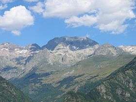 Pic de Perdiguère, lac du Portillon et tracé de l'itinéraire | |
| Highest point | |
| Elevation | 3,222 m (10,571 ft) |
| Listing | List of Pyrenean three-thousanders |
| Coordinates | 42°41′30″N 0°31′07″E / 42.69167°N 0.51861°ECoordinates: 42°41′30″N 0°31′07″E / 42.69167°N 0.51861°E [1] |
| Geography | |
  Perdiguero Location in the Pyrenees | |
| Location | France — Spain |
| Parent range | Pyrenees |
| Climbing | |
| First ascent | 1817 by Friedrich Parrot and Pierre Barrau |
| Easiest route | Arête ouest depuis le refuge du Portillon |
Perdiguero is a pyrenean summit, culminating at 3,222 m (10,571 ft), located on the French-Spanish border.
Topography
Located between the Spanish municipality of Benasque and the commune of Oô, near Bagnères-de-Luchon in the Comminges between the department of Haute-Garonne and the province of Aragon, Perdiguero is the highest summit of Haute-Garonne before la pointe de Literole.
Lake Portillon lies at its foot.
References
- ↑ Coordinates via Géoportail and WikiMapia
This article is issued from Wikipedia - version of the 7/16/2015. The text is available under the Creative Commons Attribution/Share Alike but additional terms may apply for the media files.