Pictou Landing First Nation

Pictou Landing First Nation in Nova Scotia
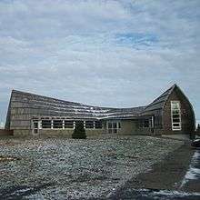
Pictou Landing Health Centre (Fisher's Grant 24)
Pictou Landing First Nations is a Mi'kmaq First Nation band government in Nova Scotia, Canada. Their territory spans five reserves that have a combined area of 527.6 hectares. The current Chief is Andrea Paul. As of 2012, the Mi'kmaq population is 459 on-Reserve, and approximately 144 off-Reserve.[1]
Chief and council
office for two years.
Composition
Pictou Landing First Nation is composed of five parts as shown:
| Community | Area | Location | Population | Date established |
|---|---|---|---|---|
| Boat Harbour West 37 | 98.2 hectares (243 acres) | 8 km. north of New Glasgow | 0 | May 18, 1961 |
| Fisher's Grant 24 | 142.7 hectares (353 acres) | 10 km. north of New Glasgow | 467 | March 3, 1866 |
| Fisher's Grant 24G | 60 hectares (150 acres) | 3.2 km. southeast of Pictou Landing | 0 | March 3, 1927 |
| Franklin Manor 22 (part) | 212.5 hectares (525 acres) | 32 km. southeast of Amherst | 0 | March 3, 1865 |
| Merigomish Harbour 31 | 14.2 hectares (35 acres) | 12.8 km. east of New Glasgow | 0 | March 3, 1865 |
References
Pictou Landing First Nation Nova Scotia Mi'kmaw Language
Coordinates: 45°40′30″N 62°39′00″W / 45.67500°N 62.65000°W
This article is issued from Wikipedia - version of the 8/2/2016. The text is available under the Creative Commons Attribution/Share Alike but additional terms may apply for the media files.