Piz Terri
| Piz Terri | |
|---|---|
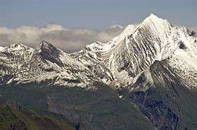 The south face of Piz Terri (right) | |
| Highest point | |
| Elevation | 3,149 m (10,331 ft) |
| Prominence | 390 m (1,280 ft) [1] |
| Parent peak | Rheinwaldhorn |
| Coordinates | 46°36′0″N 9°2′2″E / 46.60000°N 9.03389°ECoordinates: 46°36′0″N 9°2′2″E / 46.60000°N 9.03389°E |
| Geography | |
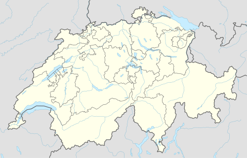 Piz Terri Location in Switzerland | |
| Location | Graubünden/Ticino, Switzerland |
| Parent range | Lepontine Alps |
Piz Terri is a mountain in the Lepontine Alps, located on the border between the cantons of Ticino and Graubünden. At 3,149 metres above sea level it is the highest summit lying on the chain between Greina and Soreda Pass. Piz Terri overlooks Lake Luzzone in Val Blenio on its west side, Val Sumvitg on its north side and Val Lumnezia on its east side. Close localities are Olivone (Val Blenio) and Vrin (Val Lumnezia).
A lake (0.183 km²[2]) is located near the summit on the northern side at 2,585 metres. The faces are steep. Only a small glacier, named Glatscher dil Terri, lies at the base of the north face.
The summit can be reached by experienced hikers via a trail on the west ridge. The normal route starts above Lake Luzzone at the Motterascio hut (2,171 metres), owned by the Swiss Alpine Club.
References
- ↑ Retrieved from the Swisstopo topographic maps. The key col is the Passo Soreda (2,759 m).
- ↑ Area retrieved from Google Earth (July 2013)
External links
-
 Media related to Piz Terri at Wikimedia Commons
 - Piz Terri on Summitpost
- Piz Terri on Hikr
- Capanna Motterascio