Potton Brook
| Potton Brook | |
| River | |
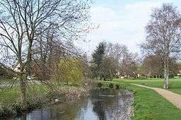 Potton Brook in Potton Park, Potton | |
| Country | England |
|---|---|
| County | Bedfordshire |
| Source | |
| - location | east of Gamlingay, Cambridgeshire, England |
| - coordinates | 52°9′5.13″N 0°9′39.54″W / 52.1514250°N 0.1609833°W |
| Mouth | |
| - elevation | 25 m (82 ft) |
| - coordinates | 52°6′48″N 0°16′37″W / 52.11333°N 0.27694°WCoordinates: 52°6′48″N 0°16′37″W / 52.11333°N 0.27694°W |
Potton Brook rises east of Gamlingay, Cambridgeshire, and flows southwest and then south through Potton and the John O'Gaunt Golf Club and into Sutton, Bedfordshire. Potton Brook curves west and northwest, and joins the River Ivel northeast of Lower Caldecote.
References
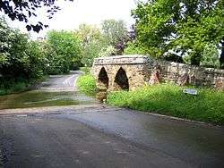
A packhorse bridge and ford across Potton Brook at Sutton in Bedfordshire
England Portal | |
| Unitary authorities | |
| Major settlements | |
| Topics |
|
This article is issued from Wikipedia - version of the 3/20/2016. The text is available under the Creative Commons Attribution/Share Alike but additional terms may apply for the media files.